Map of La Vergne, Tennessee
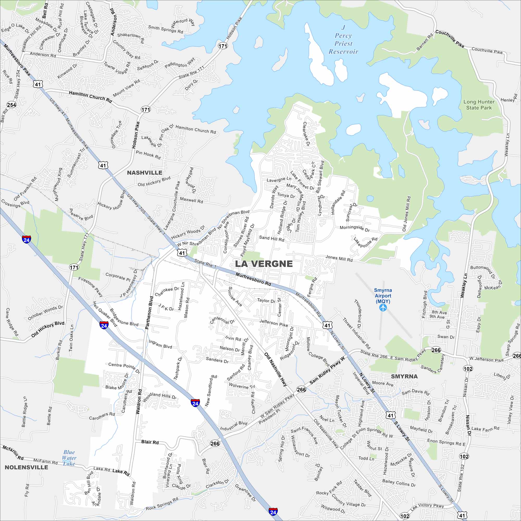
La Vergne is just southeast of Nashville. Percy Priest Lake is visible on the map, curling along the city’s northeast edge. Neighborhoods and residential streets fill the remaining space.
Map Information
On the Map
Interstates/Highways: I-24, US Hwy 41, US Hwy 70S, State Rte 1, State Rte 102, State Rte 171, State Rte 266 Major Roads: Murfreesboro Rd, Sam Ridley Pkwy, Old Nashville Hwy, Waldron Rd, Jefferson Pike, Stones River Rd, Firestone Pkwy, Fergus Rd, Nir Shreibman Blvd, Center St, Pin Hook Rd, Holland Ridge Dr, Davids Way, Sand Hill Rd, Jones Mill Rd, Blair Rd, Carothers Rd, Industrial Blvd, Lake Forest Dr, Maxwell Rd Airports: Smyrna Airport (MQY) Lakes and Reservoirs: Percy Priest Reservoir Parks and Preserves: Long Hunter State Park Nearby Communities: Nashville, Smyrna, NolensvilleTennessee State Maps
Here are our state maps of Tennessee.


City Maps of Tennessee
Explore our Tennessee map collection


