Map of Lake Elsinore, California
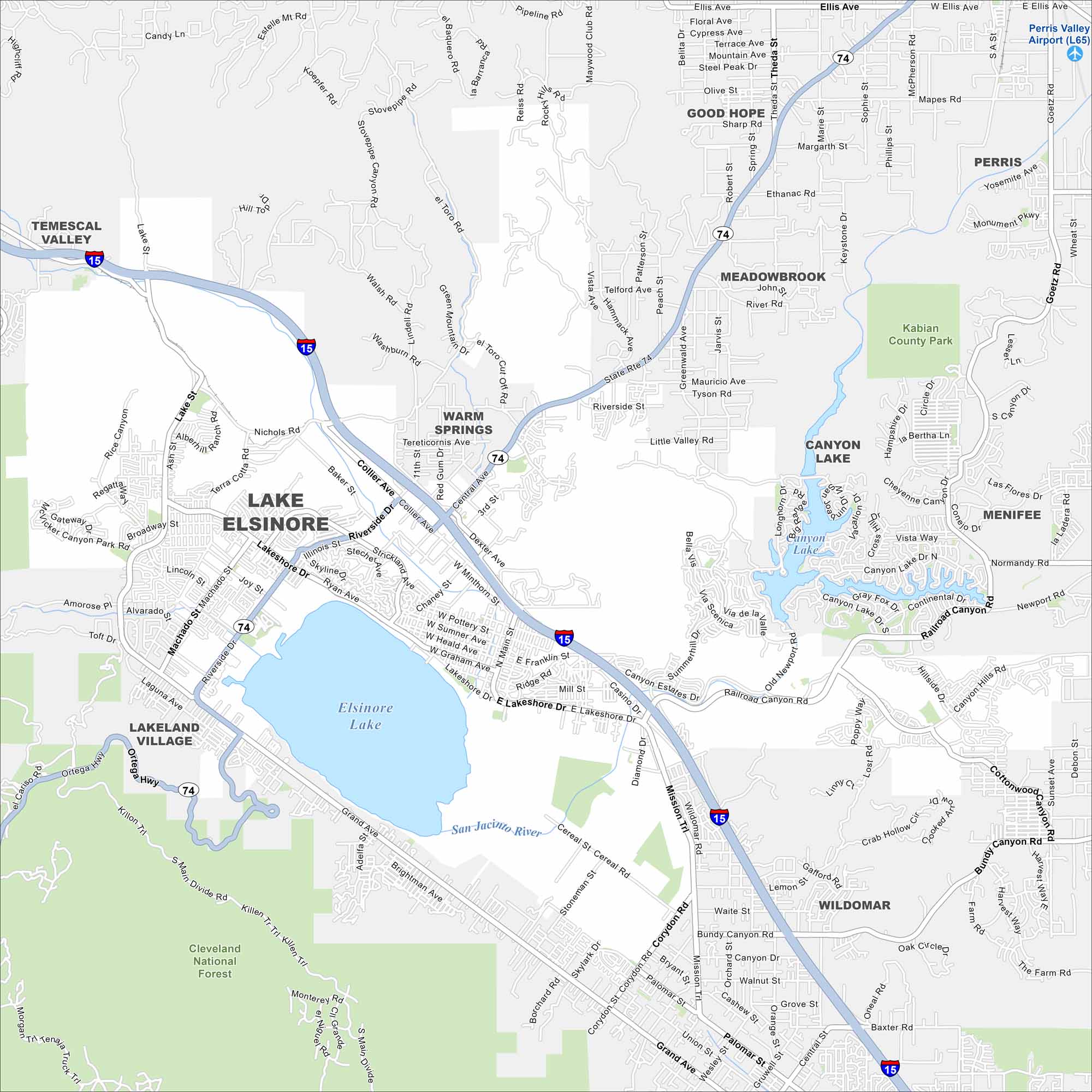
Our map highlights the massive natural lake at the heart of the city. While freeways skirt its western edge, hills rise sharply just beyond town.
California State Maps
Explore California with our state maps


Map Information
On the Map
Interstates/Highways: I-15, State Rte 74 Major Roads: Lakeshore Dr, Riverside Dr, Grand Ave, Mission Trail, Corydon Rd, Collier Ave, Central Ave, Railroad Canyon Rd, Diamond Dr, Machado St, Graham Ave, Main St, Bundy Canyon Rd, Palomar St, Clinton Keith Rd, Ortega Hwy, Monte Vista Dr, Ethanac Rd, Goetz Rd, Newport Rd Airports: Perris Valley Airport (L65) Lakes and Reservoirs: Elsinore Lake, Canyon Lake Major Rivers: San Jacinto River Parks and Preserves: Cleveland National Forest, Kabian County Park Nearby Communities: Temescal Valley, Good Hope, Meadowbrook, Perris, Canyon Lake, Menifee, Lakeland Village, WildomarCalifornia City Maps
Here are detailed maps of California


