Map of Lake Forest, California
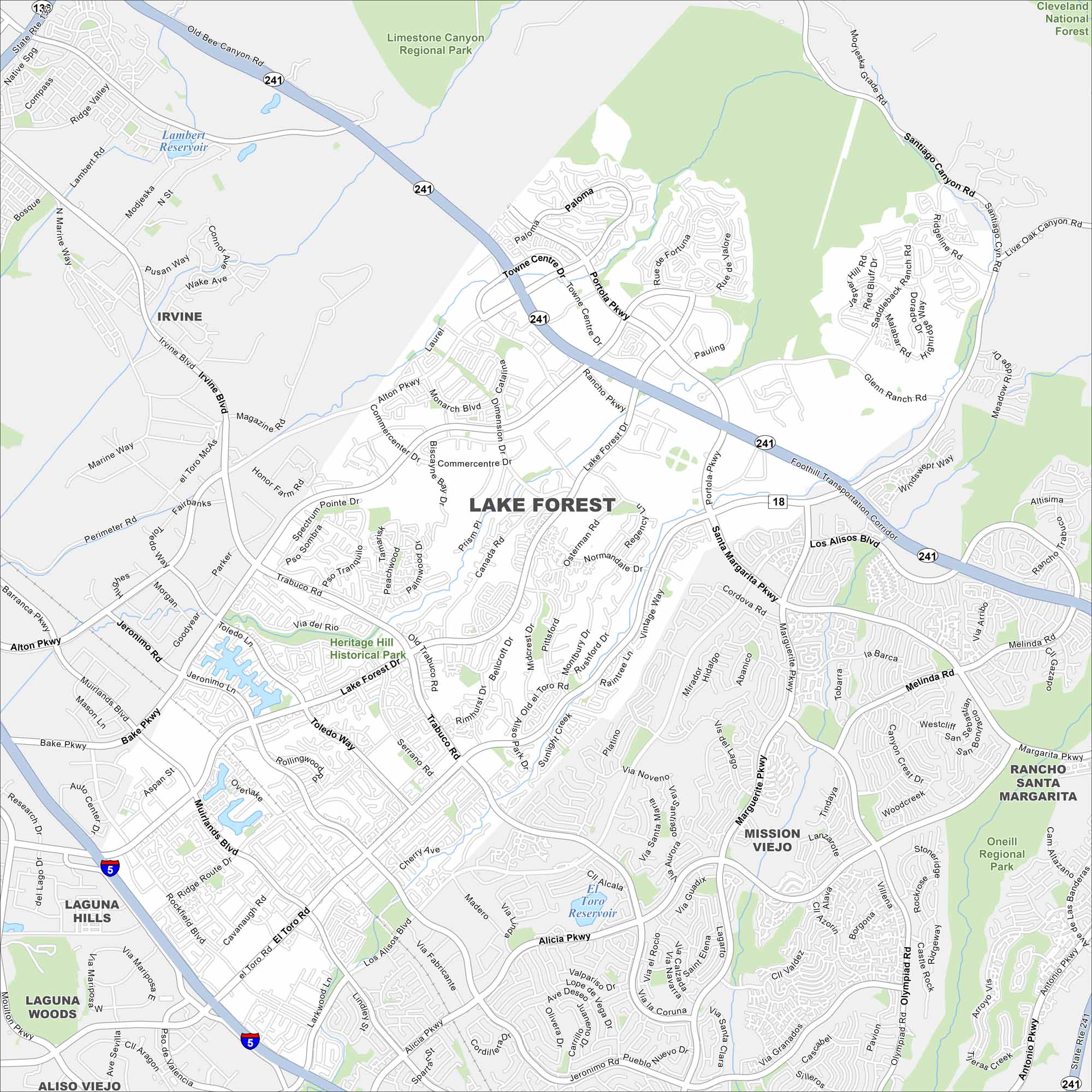
Our map of Lake Forest, California shows neighborhoods wind around forested parks and man-made lakes. Its highways and roads connecting everything. Mountains form the backdrop to the east.
California State Maps
Explore California with our state maps


Map Information
On the Map
Interstates/Highways: I-5, State Rte 241, State Rte 133 Major Roads: El Toro Rd, Lake Forest Dr, Bake Pkwy, Trabuco Rd, Alicia Pkwy, Muirlands Blvd, Rockfield Blvd, Portola Pkwy, Santa Margarita Pkwy, Los Alisos Blvd, Alton Pkwy, Irvine Blvd, Jeronimo Rd, Toledo Way, Ridge Route Dr, Serrano Rd, Dimension Dr, Commercecentre Dr, Marguerite Pkwy, Olympiad Rd Lakes and Reservoirs: Lambert Reservoir, El Toro Reservoir, Veeh Reservoir Parks and Preserves: Cleveland National Forest, Limestone Canyon Regional Park, Heritage Hill Historical Park, O’Neill Regional Park Nearby Communities: Irvine, Laguna Hills, Laguna Woods, Aliso Viejo, Mission Viejo, Rancho Santa MargaritaCalifornia City Maps
Here are detailed maps of California


