Map of Lompoc, California
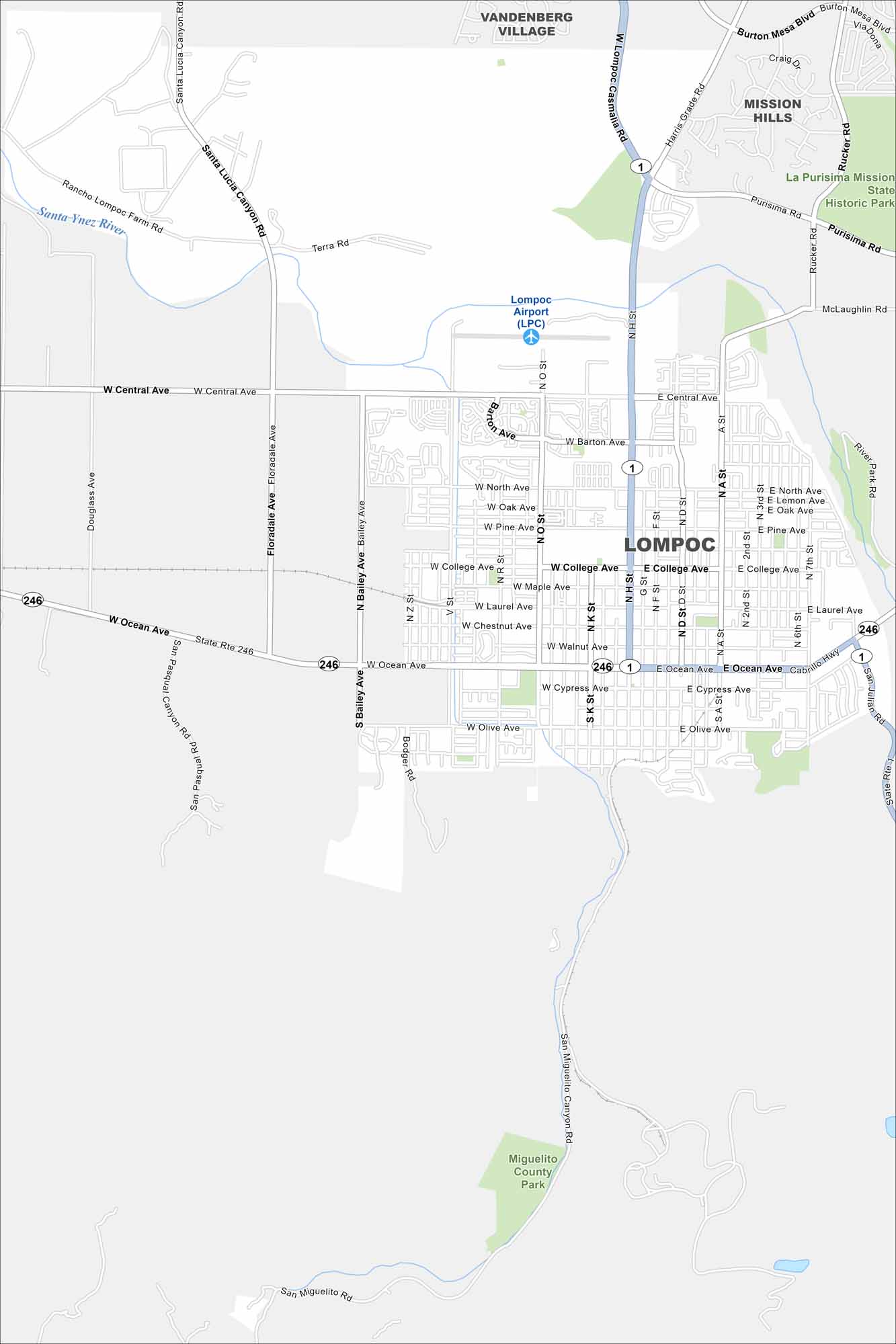
Our map of Lompoc highlights its spot in a coastal valley. Highways 1 and 246 cut through town. The city lies just inland from the Pacific.
California State Maps
Explore California with our state maps


Map Information
On the Map
Interstates/Highways: State Rte 1, State Rte 246 Major Roads: Ocean Ave, H St, Central Ave, College Ave, Pine Ave, North Ave, Olive Ave, Cypress Ave, Walnut Ave, Laurel Ave, Chestnut Ave, Maple Ave, Barton Ave, Bailey Ave, Floradale Ave, Purisima Rd, Rucker Rd, Harris Grade Rd, Mission Gate Rd, San Pasqual Canyon Rd Airports: Lompoc Airport (LPC) Major Rivers: Santa Ynez River Parks and Preserves: La Purisima Mission State Historic Park, Miguelito County Park Nearby Communities: Vandenberg Village, Mission HillsCalifornia City Maps
Here are detailed maps of California


