Map of Los Altos, California
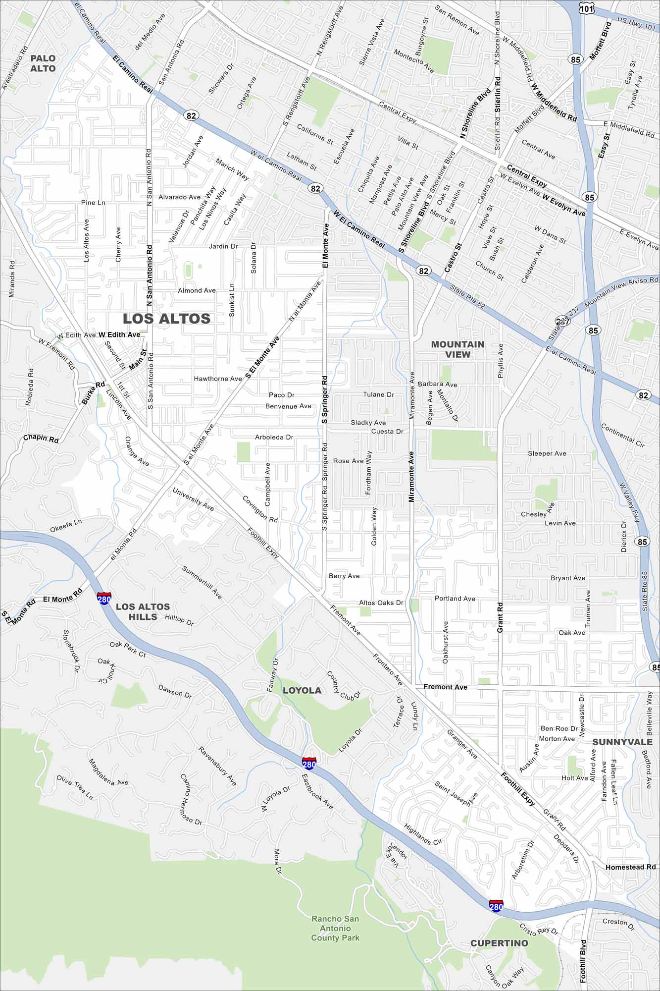
Los Altos rests at the edge of the Santa Cruz Mountains. Our map shows its neighborhoods blending into Silicon Valley. Major highways run just beyond the city limits.
California State Maps
Explore California with our state maps


Map Information
On the Map
Interstates/Highways: I-280, State Rte 82, State Rte 85, State Rte 237, US Hwy 101 Major Roads: El Camino Real, Foothill Expy, Central Expy, San Antonio Rd, El Monte Ave, Middlefield Rd, Homestead Rd, Grant Rd, Springer Rd, Miramonte Ave, Fremont Ave, Edith Ave, Almond Ave, Covington Rd, Magdalena Ave, University Ave, Main St, San Antonio Ave, California Ave, Charleston Rd Parks and Preserves: Rancho San Antonio County Park Nearby Communities: Palo Alto, Mountain View, Sunnyvale, Cupertino, Los Altos Hills, LoyolaCalifornia City Maps
Here are detailed maps of California


