Map of Malibu, California
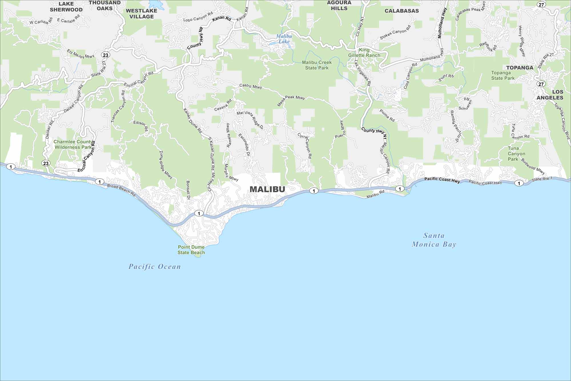
Check out Malibu stretched along the Pacific Coast Highway. Our map shows beaches lining the ocean side and mountains rising inland. The coastline defines the city.
California State Maps
Explore California with our state maps


Map Information
On the Map
Interstates/Highways: State Rte 1, State Rte 23, State Rte 27, Pacific Coast Hwy Major Roads: Kanan Dume Rd, Malibu Rd, Mulholland Hwy, Latigo Canyon Rd, Corral Canyon Rd, Las Virgenes Rd, Malibu Canyon Rd, Topanga Canyon Blvd, Decker Canyon Rd, Encinal Canyon Rd, Trancas Canyon Rd, Bonsall Dr, Broad Beach Rd, Westlake Blvd, Stokes Canyon Rd, Piuma Rd, Saddle Peak Rd, Tuna Canyon Rd, Fernwood Pacific Dr Lakes and Reservoirs: Pacific Ocean, Santa Monica Bay, Malibu Lake Parks and Preserves: Malibu Creek State Park, Topanga State Park, Charmlee County Wilderness Park, Point Dume State Beach, King Gillette Ranch, Tuna Canyon Park Nearby Communities: Agoura Hills, Calabasas, Topanga, Los Angeles, Thousand Oaks, Westlake VillageCalifornia City Maps
Here are detailed maps of California


