Map of Marshfield, Wisconsin
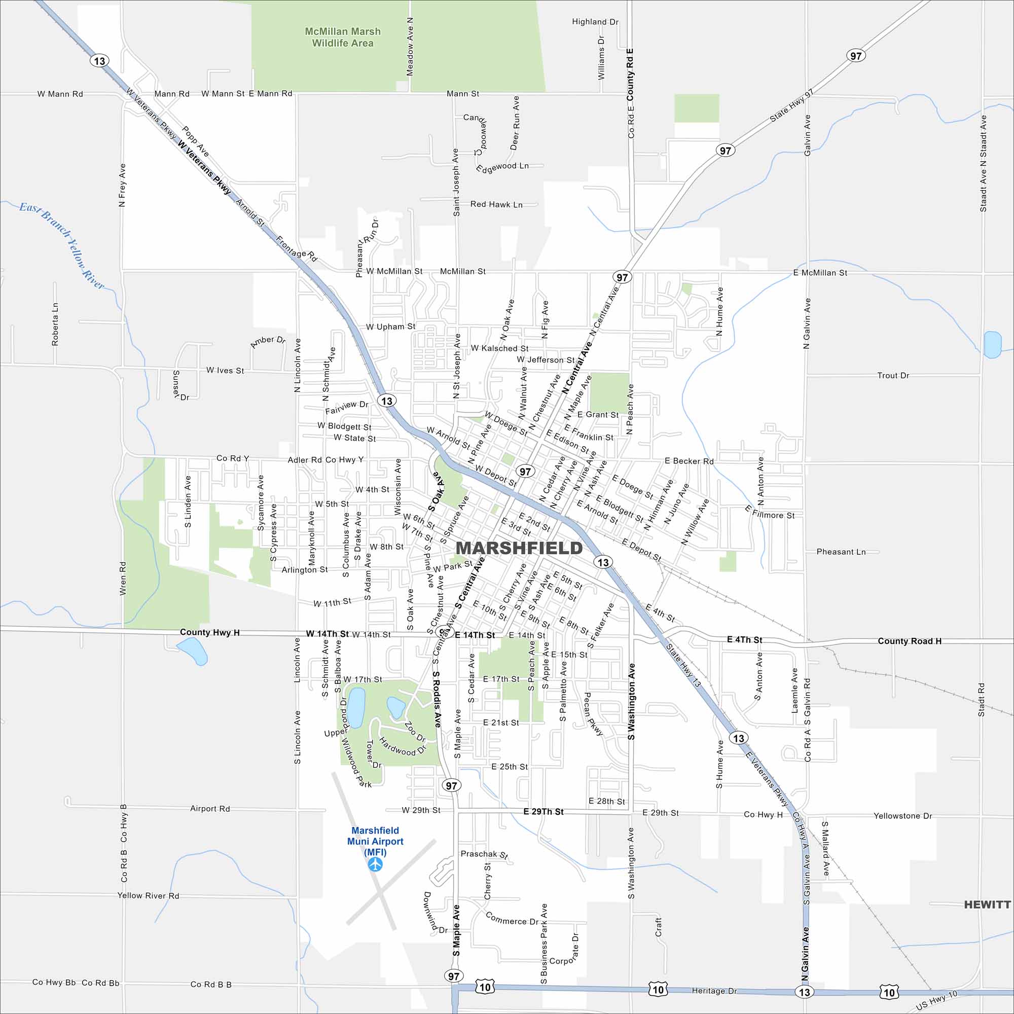
See Marshfield on our map, located in central Wisconsin. You can find this city in both Wood and Marathon counties. Our map includes its roads, parks and waterways.
Map Information
On the Map
Interstates/Highways: US Hwy 10, State Rte 13, State Rte 97 Major Roads: Central Ave, Veterans Pkwy, Arnold St, McMillan St, Upham St, 4th St, 14th St, 29th St, Washington Ave, Peach Ave, Oak Ave, Galvin Ave, St Joseph Ave, Depot St, Adler Rd, Ives St, Lincoln Ave, Hume Ave, 5th St Airports: Marshfield Muni Airport (MFI) Major Rivers: East Branch Yellow River, Yellow River Parks and Preserves: McMillan Marsh Wildlife Area Nearby Communities: HewittWisconsin State Maps
Discover maps of the Badger State.


City Maps of Wisconsin
See our Wisconsin maps designed for clarity.


