Map of Martinez, California
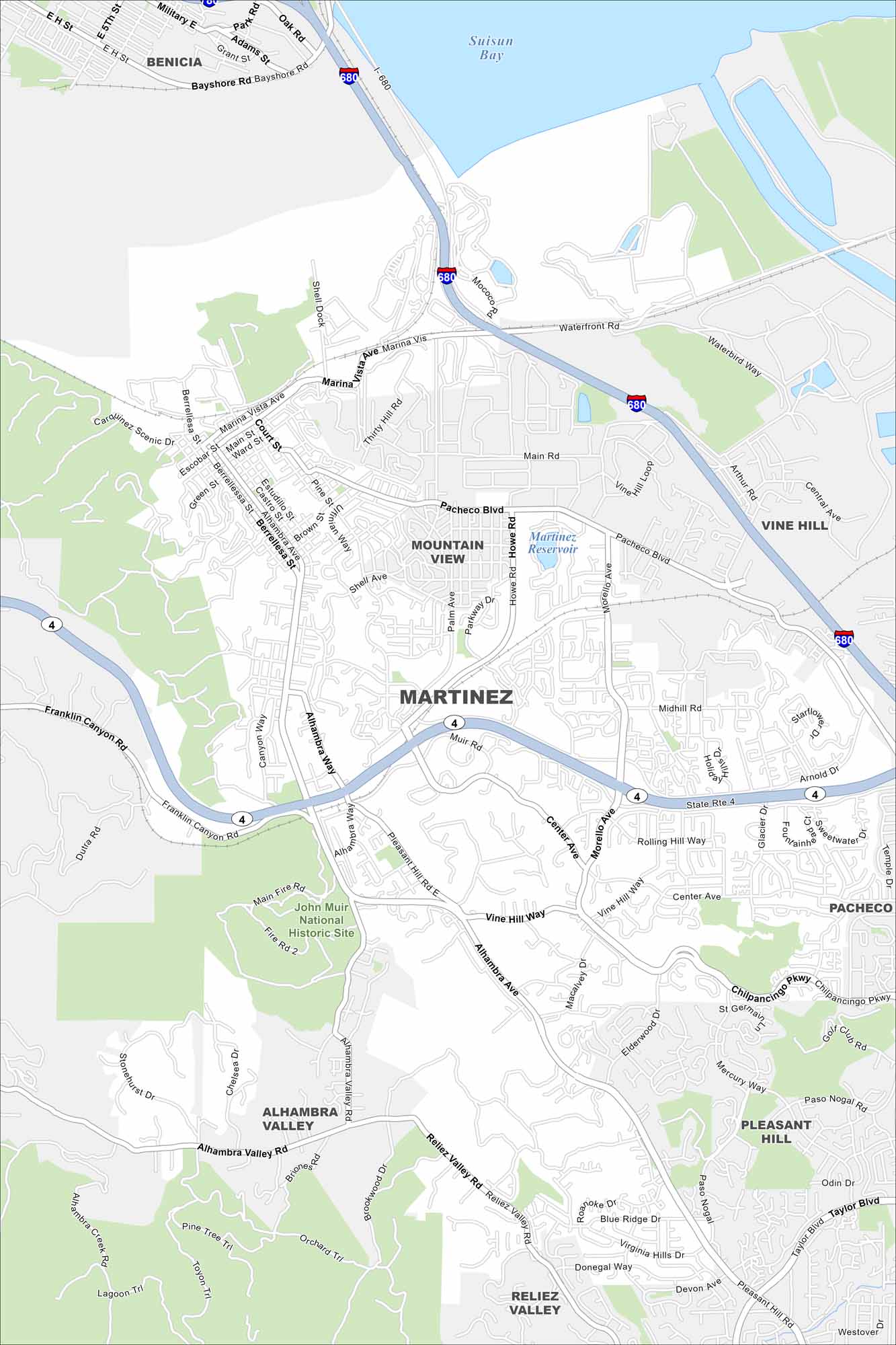
Explore Martinez, California with our road map. Located on the southern shore of the Carquinez Strait, historic downtown streets define the core.
California State Maps
Explore California with our state maps


Map Information
On the Map
Interstates/Highways: I-680, State Rte 4 Major Roads: Alhambra Ave, Marina Vista Ave, Pacheco Blvd, Pleasant Hill Rd, Morello Ave, Center Ave, Alhambra Valley Rd, Reliez Valley Rd, Taylor Blvd, Arnold Dr, Glacier Dr, Main St, Waterfront Rd, Pine St, Court St, Escobar St, Berrellesa St, Franklin Canyon Rd, McEwen Rd, Arthur Rd Lakes and Reservoirs: Suisun Bay, Martinez Reservoir Parks and Preserves: John Muir National Historic Site Nearby Communities: Benicia, Mountain View, Vine Hill, Pacheco, Pleasant Hill, Reliez Valley, Alhambra ValleyCalifornia City Maps
Here are detailed maps of California


