Map of Menlo Park, California
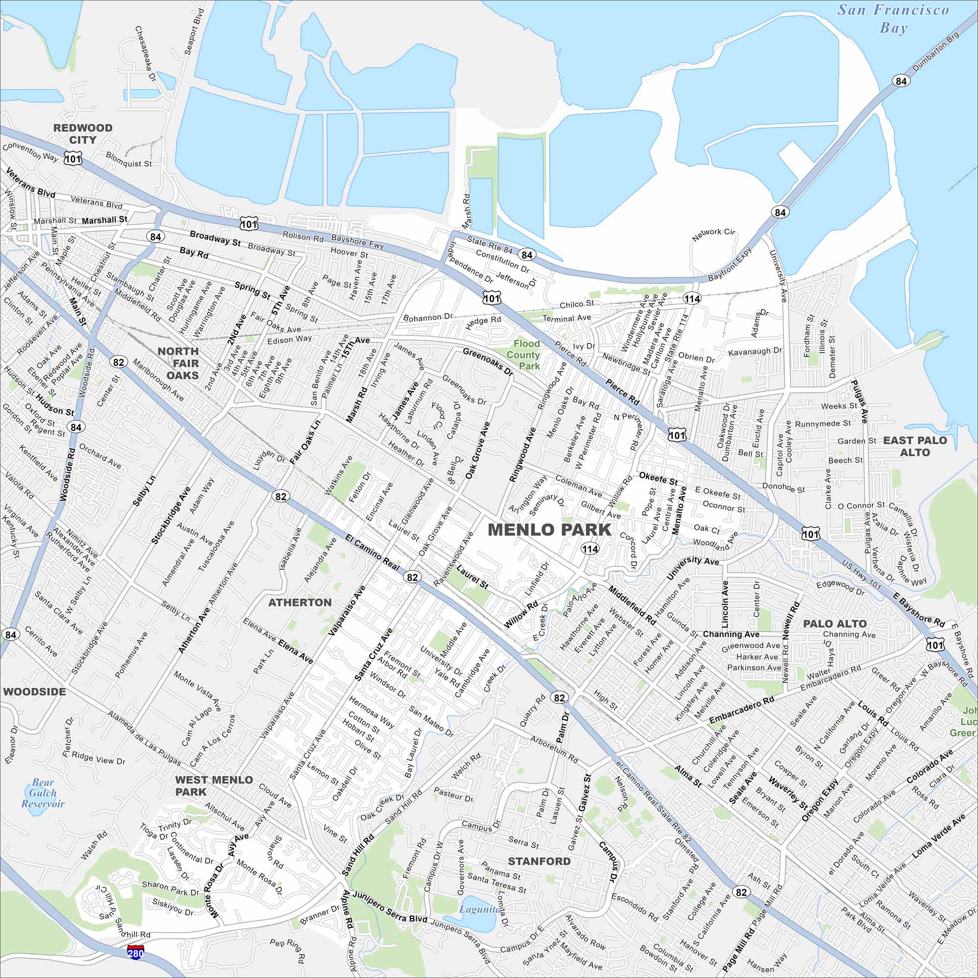
Menlo Park sits at the edge of San Francisco Bay and is central to Silicon Valley. Our map shows its reservoirs, streets, and green spaces. There are various tech campuses here, including Stanford’s influence nearby.
California State Maps
Explore California with our state maps


Map Information
On the Map
Interstates/Highways: US Hwy 101, I-280, State Rte 82, State Rte 84, State Rte 114 Major Roads: El Camino Real, Willow Rd, Bayfront Expy, Marsh Rd, Sand Hill Rd, Middlefield Rd, Santa Cruz Ave, Valparaiso Ave, University Ave, Embarcadero Rd, Alpine Rd, Alameda de las Pulgas, Woodside Rd, Broadway, Main St, Dumbarton Brg, Page Mill Rd, Arboretum Rd, Campus Dr, Junipero Serra Blvd Lakes and Reservoirs: San Francisco Bay, Bear Gulch Reservoir, Lake Lagunita Parks and Preserves: Flood County Park Nearby Communities: Redwood City, North Fair Oaks, Atherton, Woodside, West Menlo Park, Stanford, Palo Alto, East Palo AltoCalifornia City Maps
Here are detailed maps of California


