Map of Mill Valley, California
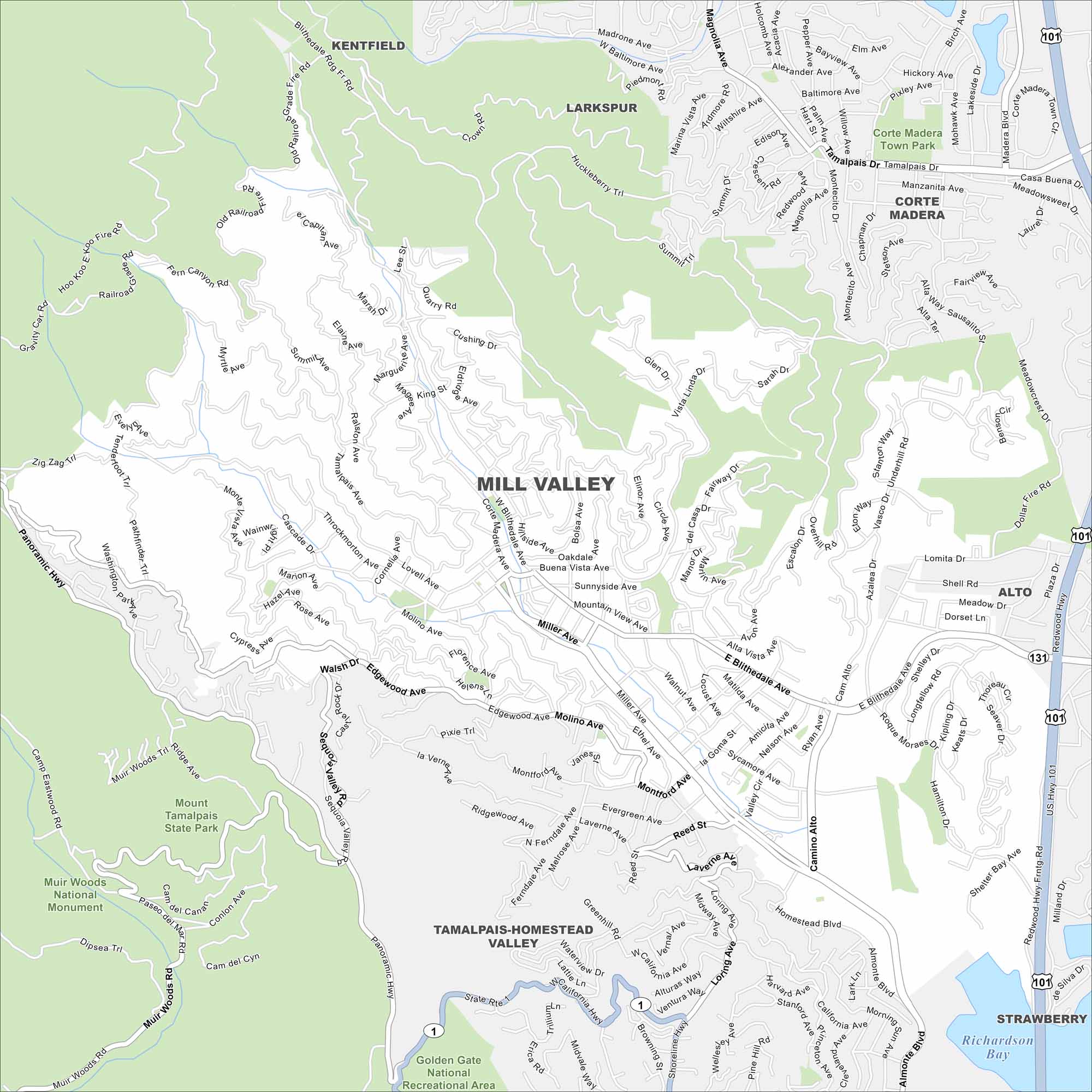
Discover Mill Valley using our road map. It sits at the base of Mount Tamalpais, surrounded by redwoods. The town blends natural beauty with easy access to San Francisco. It’s part of Marin County.
California State Maps
Explore California with our state maps


Map Information
On the Map
Interstates/Highways: US Hwy 101, State Rte 1, State Rte 131, Redwood Hwy Major Roads: Miller Ave, E Blithedale Ave, W Blithedale Ave, Molino Ave, Panoramic Hwy, Muir Woods Rd, Shoreline Hwy, Camino Alto, Almonte Blvd, Edgewood Ave, Throckmorton Ave, Lovell Ave, Sunnyside Ave, Cascade Dr, Marion Ave, Summit Ave, Middlefield Rd, Tiburon Blvd, Strawberry Dr Lakes and Reservoirs: Richardson Bay Parks and Preserves: Mount Tamalpais State Park, Muir Woods National Monument, Golden Gate National Recreational Area, Corte Madera Town Park Nearby Communities: Kentfield, Larkspur, Corte Madera, Tamalpais-Homestead Valley, Strawberry, AltoCalifornia City Maps
Here are detailed maps of California


