Map of Mission Viejo, California
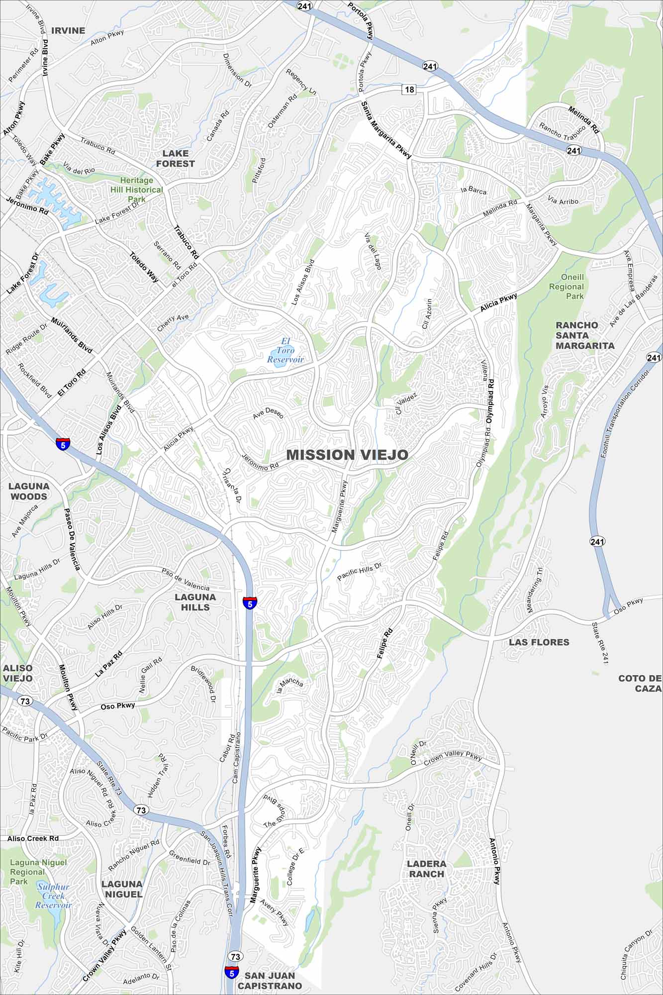
Get to know Mission Viejo using our road map. The planned neighborhoods surround a central lake, with hills on the edge of the city. It’s one of the classic master-planned communities in the U.S.
California State Maps
Explore California with our state maps


Map Information
On the Map
Interstates/Highways: I-5, State Rte 18, State Rte 73, State Rte 241 Major Roads: Marguerite Pkwy, Alicia Pkwy, Jeronimo Rd, Los Alisos Blvd, Trabuco Rd, Muirlands Blvd, El Toro Rd, Oso Pkwy, La Paz Rd, Felipe Rd, Santa Margarita Pkwy, Olympiad Rd, Antonio Pkwy, Crown Valley Pkwy, Forbes Rd, Cabot Rd, Moulton Pkwy, Paseo De Valencia, Melinda Rd, Portola Pkwy Lakes and Reservoirs: El Toro Reservoir, Sulphur Creek Reservoir Parks and Preserves: Heritage Hill Historical Park, Oneill Regional Park, Laguna Niguel Regional Park Nearby Communities: Irvine, Lake Forest, Rancho Santa Margarita, Laguna Woods, Laguna Hills, Aliso Viejo, Las Flores, Coto De Caza, Ladera Ranch, San Juan Capistrano, Laguna NiguelCalifornia City Maps
Here are detailed maps of California


