Map of Modesto, California
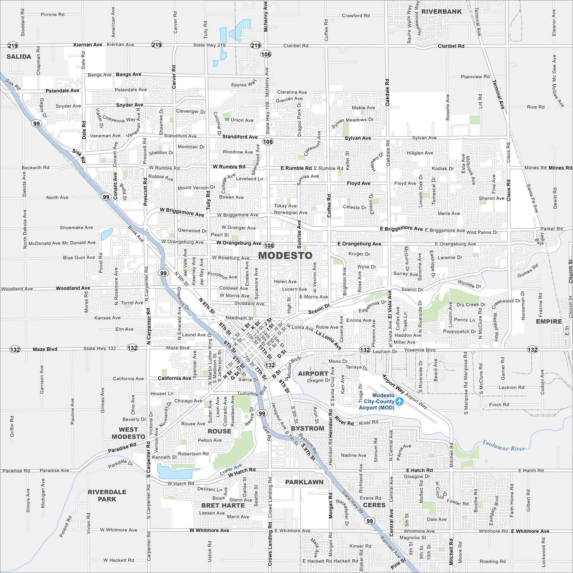
Our map of Modesto shows a city at the heart of the Central Valley. Streets spread across farmland, with the Tuolumne River flowing along the south. Agriculture, especially almonds, plays a big role here.
California State Maps
Explore California with our state maps


Map Information
On the Map
Interstates/Highways: State Hwy 99, State Hwy 108, State Hwy 132, State Hwy 219 Major Roads: McHenry Ave, Briggsmore Ave, Orangeburg Ave, Scenic Dr, Hatch Rd, Sisk Rd, Carpenter Rd, Tully Rd, Coffee Rd, Oakdale Rd, Claus Rd, Yosemite Blvd, Maze Blvd, Paradise Rd, Whitmore Rd, Pelandale Ave, Standiford Ave, Rumble Rd, Kiernan Ave, Ninth St Airports: Modesto City-County Airport (MOD) Major Rivers: Tuolumne River Nearby Communities: Salida, Riverbank, Empire, Ceres, Bystrom, Rouse, West ModestoCalifornia City Maps
Here are detailed maps of California


