Map of Monterey, California
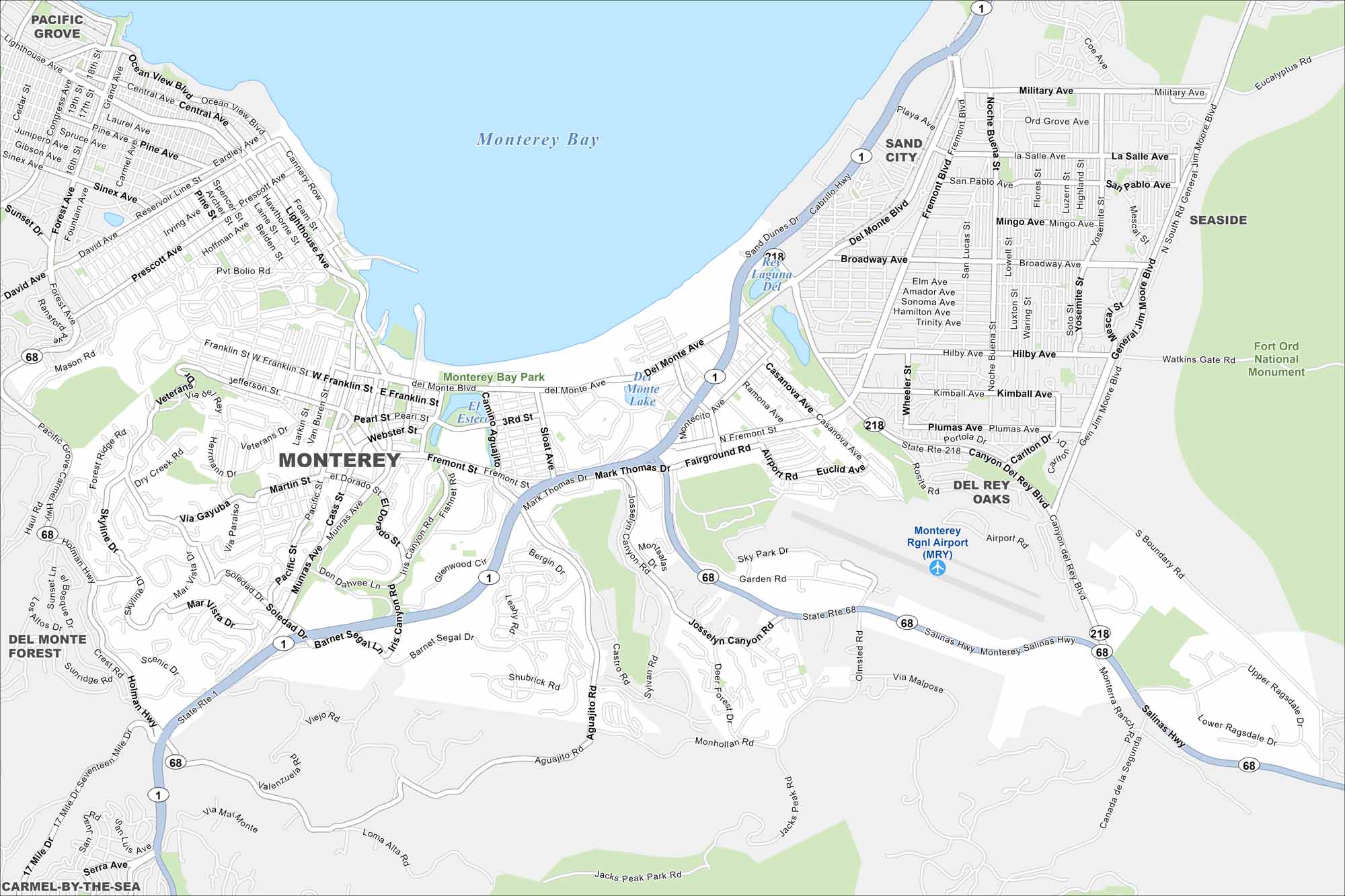
Monterey sits on the rocky Pacific coast. Our map shows Cannery Row, the waterfront, and coastal parks. Tourism, history, and marine life all define the city.
California State Maps
Explore California with our state maps


Map Information
On the Map
Interstates/Highways: State Rte 1, State Rte 68, State Rte 218, Salinas Hwy, Holman Hwy Major Roads: Munras Ave, Soledad Dr, Fremont St, Del Monte Ave, Mark Thomas Dr, Aguajito Rd, Pacific St, Franklin St, Webster St, Lighthouse Ave, Cannery Row, Ocean View Blvd, Skyline Dr, Josselyn Canyon Rd, Garden Rd, Airport Rd, Olmsted Rd, Monhollan Rd Airports: Monterey Rgnl Airport (MRY) Lakes and Reservoirs: Monterey Bay, El Estero, Del Monte Lake, Roberts Lake, Laguna Del Rey Parks and Preserves: Monterey Bay Park, Fort Ord National Monument Nearby Communities: Pacific Grove, Sand City, Seaside, Del Rey Oaks, Del Monte Forest, Carmel-By-The-SeaCalifornia City Maps
Here are detailed maps of California


