Map of Monterey Park, California
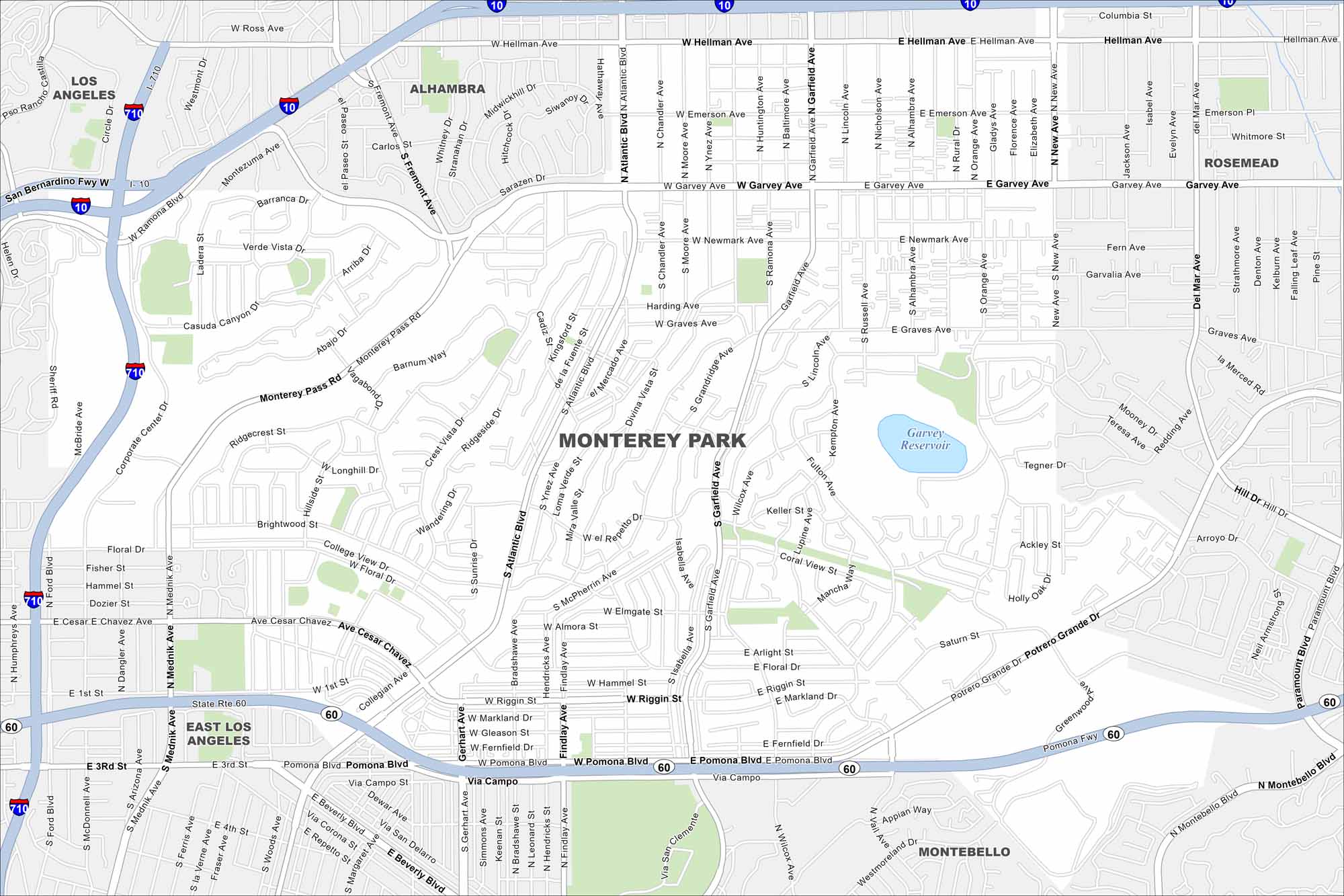
Explore Monterey Park with our road map. Located in the San Gabriel Valley, it’s well known for its strong Asian-American community.
California State Maps
Explore California with our state maps


Map Information
On the Map
Interstates/Highways: I-10, I-710, State Rte 60 Major Roads: Atlantic Blvd, Garfield Ave, Garvey Ave, Newmark Ave, Hellman Ave, Pomona Blvd, Riggin St, Floral Dr, Cesar Chavez Ave, Corporate Center Dr, Monterey Pass Rd, Crest Vista Dr, Emerson Ave, Graves Ave, Potrero Grande Dr, Paramount Blvd, Wilcox Ave, Chandler Ave, Mednik Ave Lakes and Reservoirs: Garvey Reservoir Nearby Communities: Los Angeles, Alhambra, Rosemead, East Los Angeles, MontebelloCalifornia City Maps
Here are detailed maps of California


