Map of Morristown, Tennessee
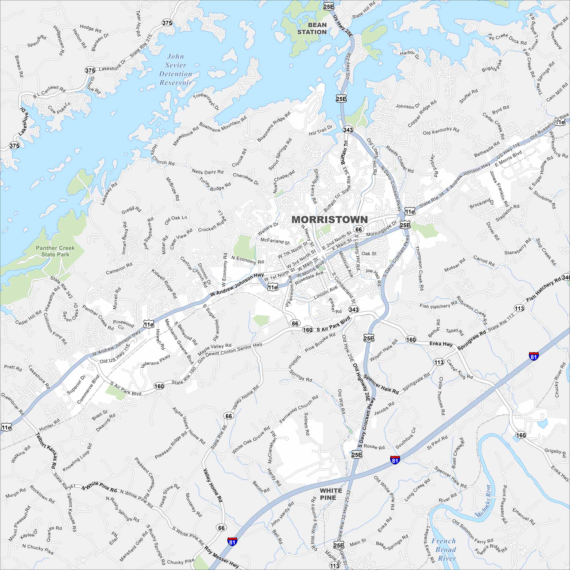
Take a look at Morristown map, located in East Tennessee. The city spreads between Cherokee Lake and the foothills of the Appalachians. It’s well known as a manufacturing and retail center.
Map Information
On the Map
Interstates/Highways: I-81, US Hwy 11E, US Hwy 25E, State Rte 34, State Rte 66, State Rte 113, State Rte 116, State Rte 160, State Rte 342, State Rte 343, State Rte 375 Major Roads: Andrew Johnson Hwy, Main St, Morris Blvd, Cumberland St, Davy Crockett Pkwy, Buffalo Trl, Fairmont Ave, Merchants Greene Blvd, Veterans Pkwy, Air Park Blvd, Thompson Creek Rd, Enka Hwy, White Pine Rd, Roy Messer Hwy, Kidwell Ridge Rd, Cherokee Dr, Walters Dr, McFarland St, Morningside Dr, Southfork Cir Lakes and Reservoirs: John Sevier Detention Reservoir Major Rivers: French Broad River Parks and Preserves: Panther Creek State Park Nearby Communities: Bean Station, White PineTennessee State Maps
Here are our state maps of Tennessee.


City Maps of Tennessee
Explore our Tennessee map collection


