Map of Morro Bay, California
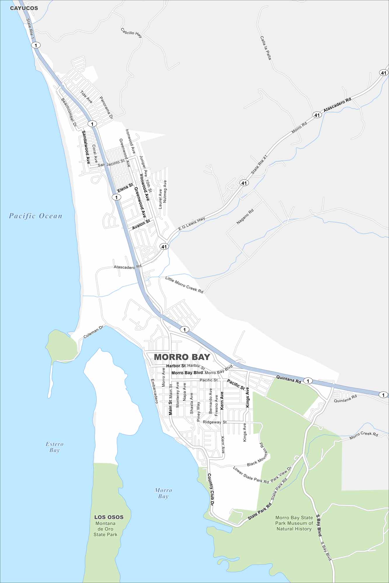
Explore Morro Bay with our map. Located in the Central Coast, the harbor and Morro Rock are unmistakable landmarks. It’s both a fishing town and a tourist stop.
California State Maps
Explore California with our state maps


Map Information
On the Map
Interstates/Highways: State Rte 1, State Rte 41 Major Roads: Main St, Morro Bay Blvd, Quintana Rd, Atascadero Rd, South Bay Blvd, Embarcadero, Harbor St, Pacific St, San Jacinto St, Ironwood Ave, Beachcomber Dr, Yerba Buena St, Kings Ave, Piney Way, Napa Ave, Shasta Ave, Bernardo Ave, Kern Ave, State Park Rd, Park View Dr Lakes and Reservoirs: Pacific Ocean, Estero Bay, Morro Bay Parks and Preserves: Morro Bay State Park, Montana de Oro State Park Nearby Communities: Cayucos, Los OsosCalifornia City Maps
Here are detailed maps of California


