Map of Mount Juliet, Tennessee
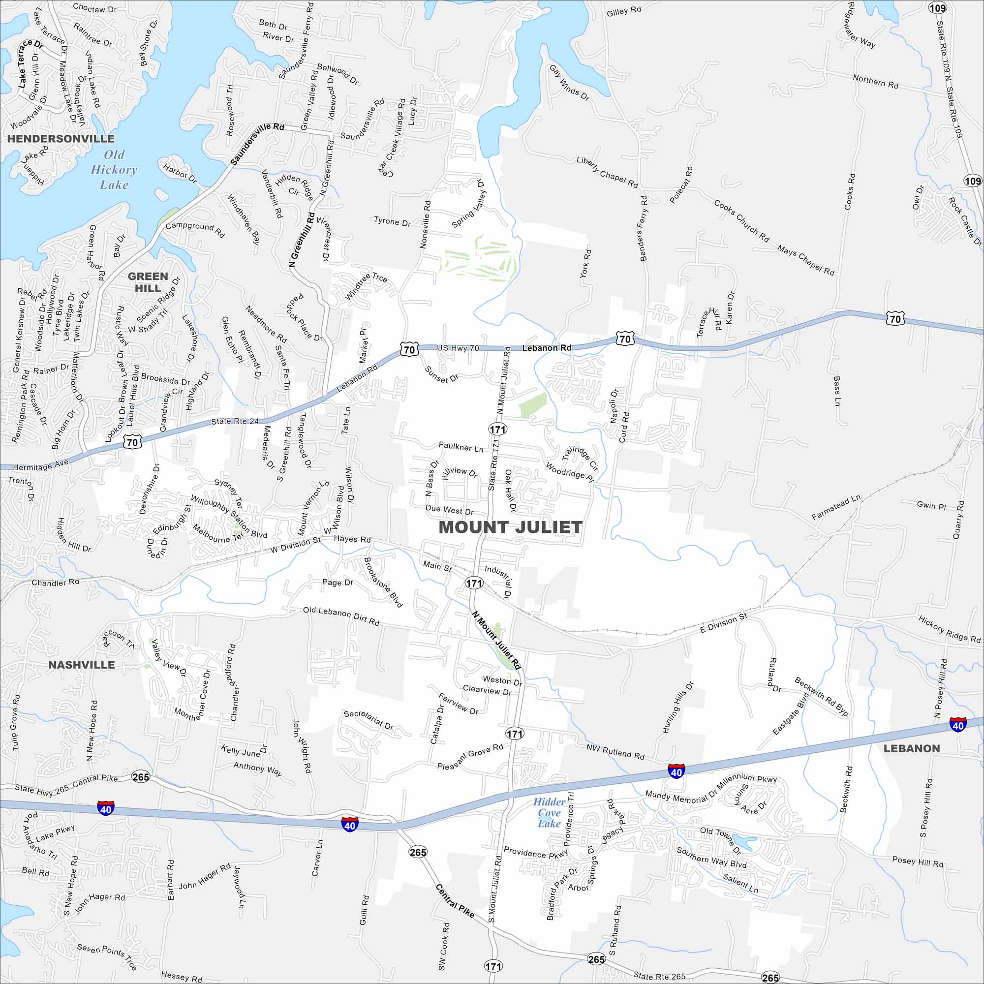
Mount Juliet lies east of Nashville. Our map shows this suburban area, anchored by major highways. The city has become a fast-growing commuter hub so growth is spreading outward.
Map Information
On the Map
Interstates/Highways: I-40, US Hwy 70, State Rte 109, State Rte 171, State Rte 265 Major Roads: Lebanon Rd, Mount Juliet Rd, Division St, Main St, Central Pike, Providence Pkwy, Belinda Pkwy, Old Lebanon Dirt Rd, Willoughby Station Blvd, Melbourne Dr, Nonaville Rd, Saundersville Rd, Curd Rd, Golden Bear Gateway, Rutland Rd, Beckwith Rd, Pleasant Grove Rd, Secretariat Dr, Park Dr, South Rd Lakes and Reservoirs: Old Hickory Lake, Hidden Cove Lake Nearby Communities: Nashville, Lebanon, Hendersonville, Green HillTennessee State Maps
Here are our state maps of Tennessee.


City Maps of Tennessee
Explore our Tennessee map collection


