Map of Murfreesboro, Tennessee
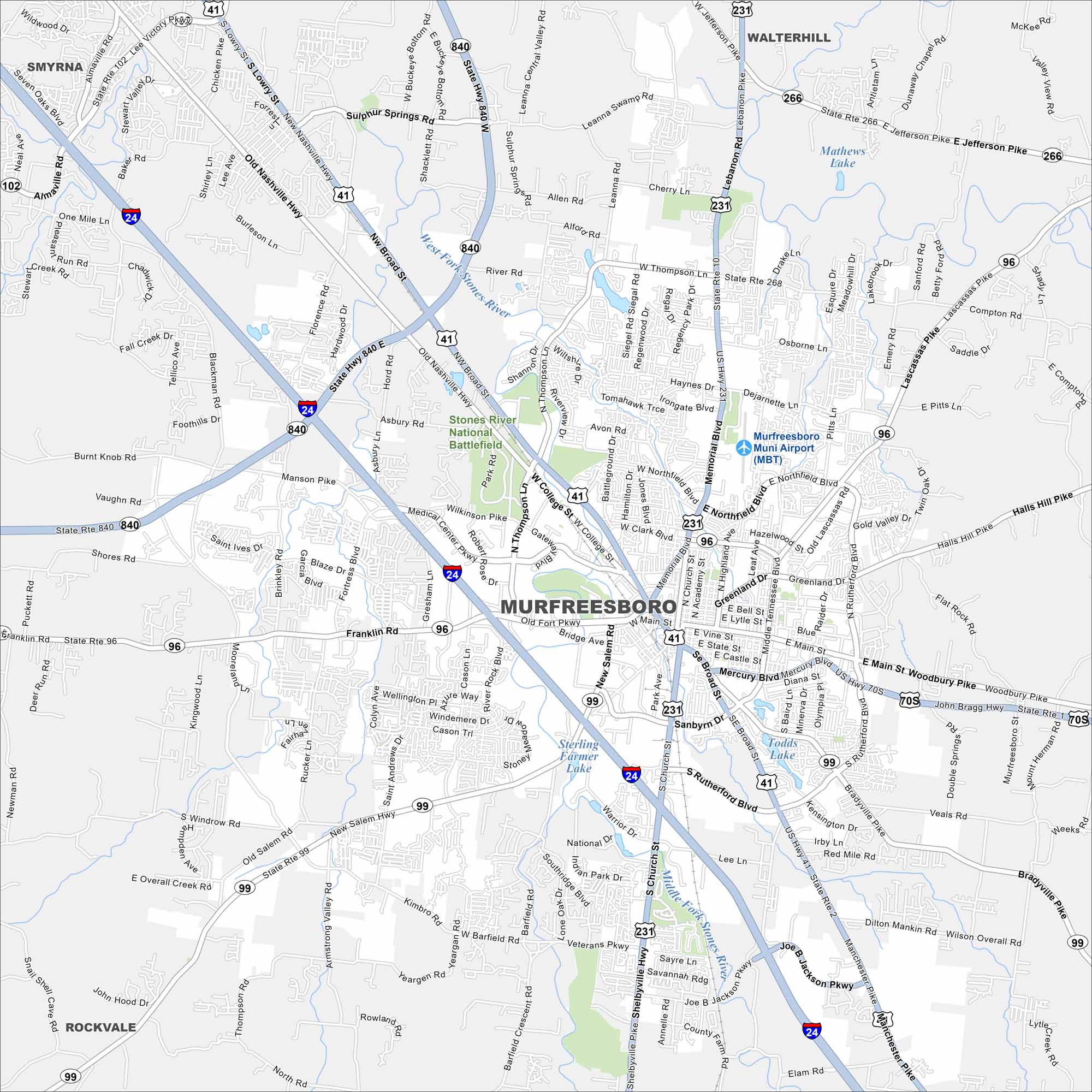
Discover Murfreesboro on our map of Middle Tennessee. The downtown square, parks and major highways stand out the most. The city played a pivotal role in Civil War history.
Map Information
On the Map
Interstates/Highways: I-24, US Hwy 41, US Hwy 70S, US Hwy 231, State Rte 1, State Rte 2, State Rte 10, State Rte 96, State Rte 99, State Rte 266, State Rte 268, State Hwy 840 Major Roads: Broad St, Memorial Blvd, Old Fort Pkwy, Mercury Blvd, Church St, Rutherford Blvd, Thompson Ln, Northfield Blvd, Clark Blvd, Middle Tennessee Blvd, Main St, Bradyville Pike, Manchester Pike, Shelbyville Hwy, Salem Hwy, Franklin Rd, Manson Pike, Medical Center Pkwy, Lascassas Pike, Halls Hill Pike Airports: Murfreesboro Muni Airport (MBT) Lakes and Reservoirs: Mathews Lake, Sterling Farmer Lake, Todds Lake Major Rivers: West Fork Stones River, Middle Fork Stones River Parks and Preserves: Stones River National Battlefield Nearby Communities: Smyrna, Walterhill, RockvaleTennessee State Maps
Here are our state maps of Tennessee.


City Maps of Tennessee
Explore our Tennessee map collection


