Map of Napa, California
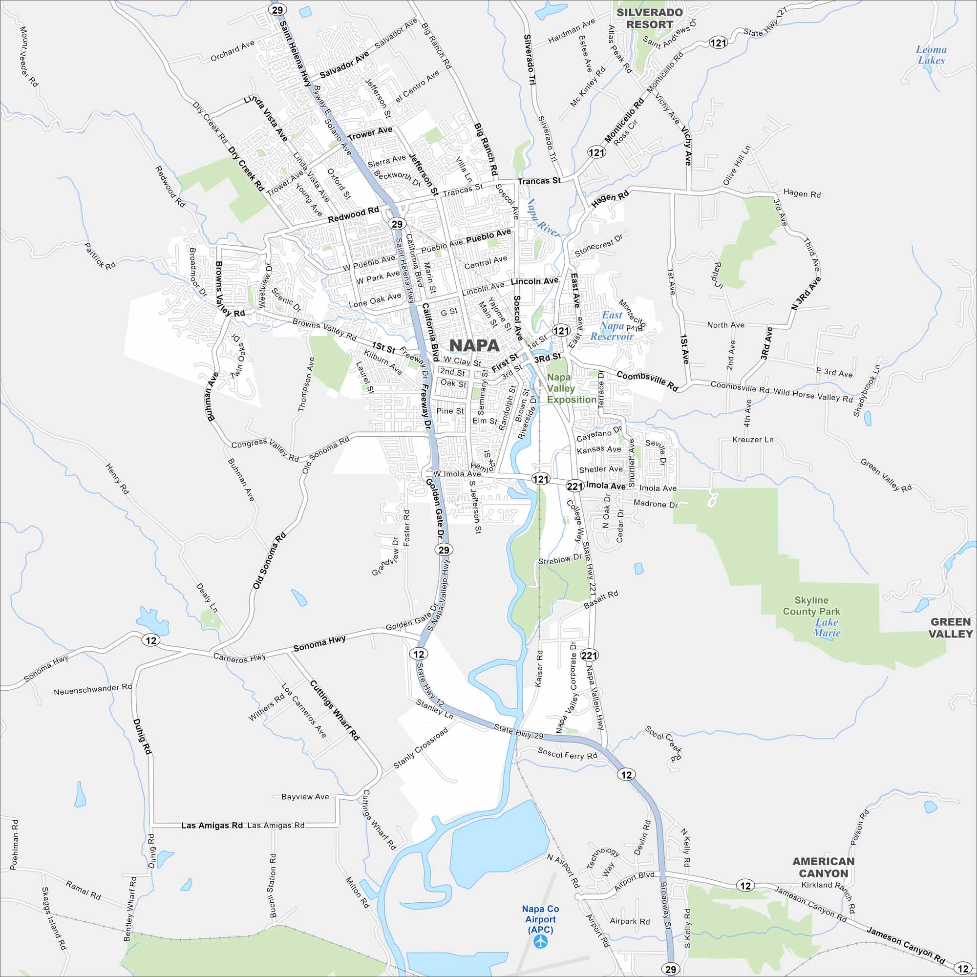
Explore Napa with our map, where vineyards line the valley floor. Downtown clusters along the Napa River, with highways branching out to wine country. The surrounding hills shape much of the layout.
California State Maps
Explore California with our state maps


Map Information
On the Map
Interstates/Highways: State Rte 12, State Rte 29, State Rte 121, State Rte 221 Major Roads: Main St, Soscol Ave, Jefferson St, Imola Ave, Trancas St, Trower Ave, Silverado Trl, Big Ranch Rd, Salvador Ave, Coombsville Rd, 1st St, 3rd St, California Blvd, Browns Valley Rd, Sonoma Hwy, Stanly Crossroad, Kelly Rd, Jameson Canyon Rd, Airport Rd, Broadway St Airports: Napa Co Airport (APC) Lakes and Reservoirs: East Napa Reservoir, Leoma Lakes Major Rivers: Napa River Parks and Preserves: Skyline County Park Nearby Communities: American Canyon, Green Valley, Silverado ResortCalifornia City Maps
Here are detailed maps of California


