Map of Newark, New Jersey
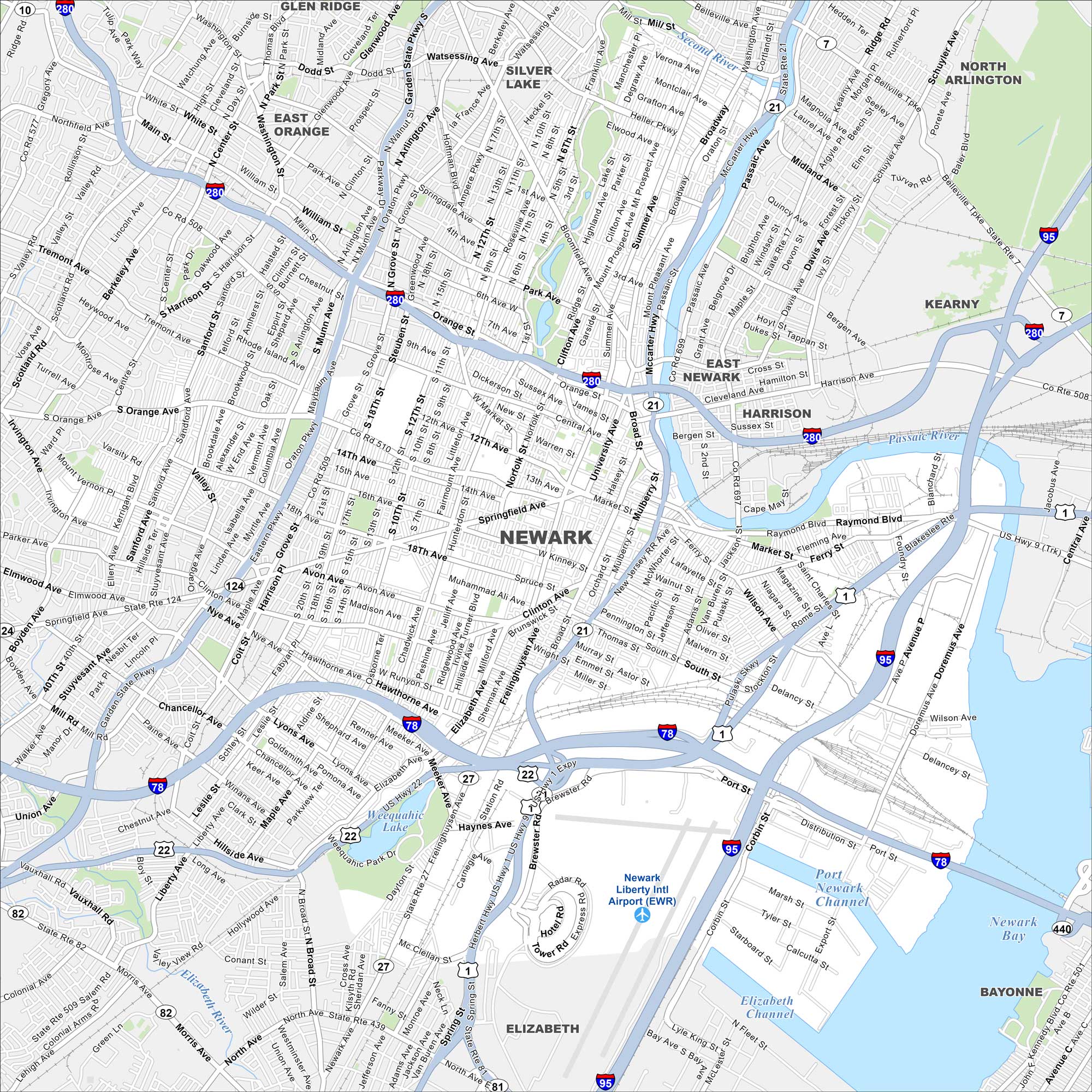
Newark sits on the Passaic River across from Manhattan. Check out our map to see its dense downtown, major highways, and busy port. Newark Liberty International Airport dominates its southern edge.
Map Information
On the Map
Interstates/Highways: I-280, I-78, I-95, State Rte 21, US Hwy 1, US Hwy 9, State Rte 27, State Rte 82, State Rte 440, State Rte 508, State Rte 509, State Rte 21, McCarter Hwy Major Roads: Broad St, Market St, Springfield Ave, Clinton Ave, Elizabeth Ave, Bloomfield Ave, Park Ave, Central Ave, South Orange Ave, Lyons Ave, Frelinghuysen Ave, Raymond Blvd, Ferry St, Wilson Ave, Doremus Ave, Port St, Corbin St, Chancellor Ave, Heller Pkwy Airports: Newark Liberty Intl Airport (EWR) Lakes and Reservoirs: Weequahic Lake, Newark Bay Major Rivers: Passaic River, Second River, Elizabeth River Nearby Communities: Glen Ridge, East Orange, Silver Lake, North Arlington, Kearny, East Newark, Harrison, Bayonne, ElizabethNew Jersey State Maps
Explore maps from the Garden State.


City Maps of New Jersey
Newark and New Jersey cities in complete detail


