Map of Norco, California
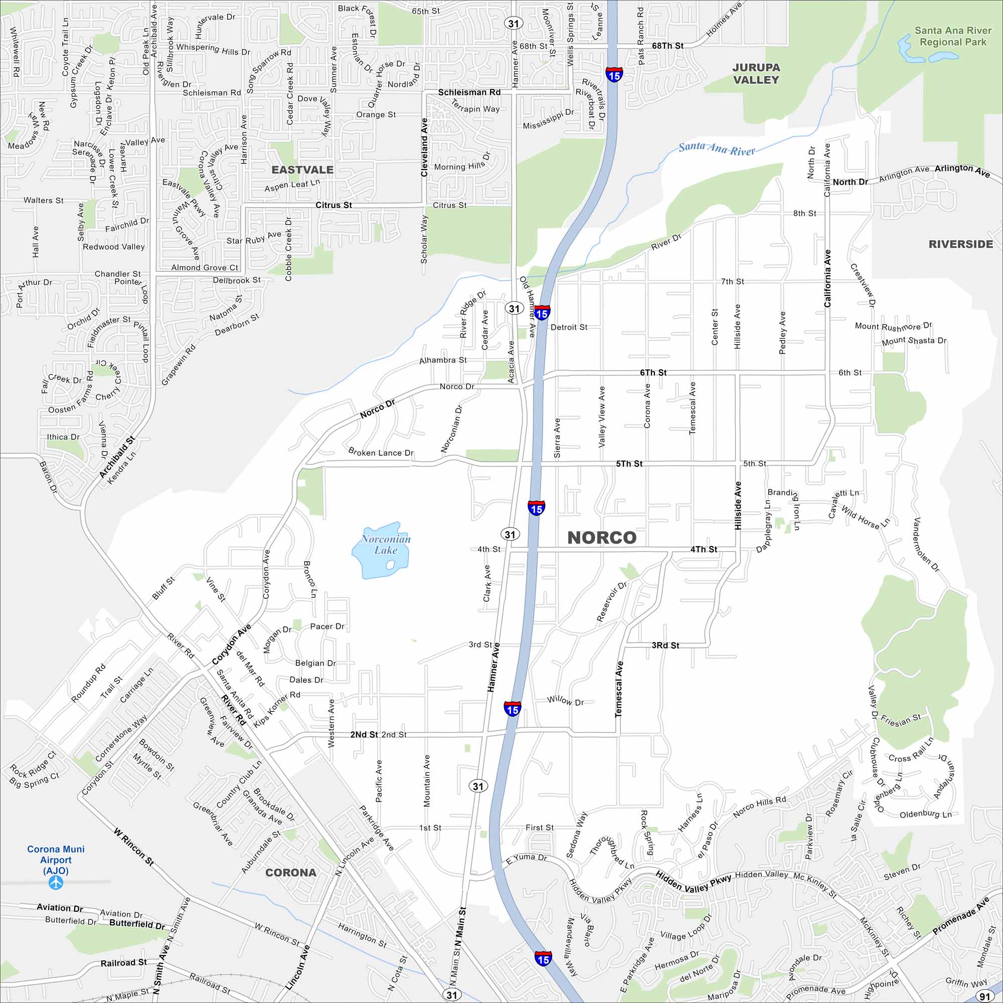
Our map of Norco highlights a community known for its rural, horse-friendly streets. The map shows large residential lots and streets. This is why it’s often called “Horsetown USA”.
California State Maps
Explore California with our state maps


Map Information
On the Map
Interstates/Highways: I-15, State Rte 31, State Rte 91 Major Roads: Hamner Ave, Norco Dr, 6th St, 5th St, 4th St, 3rd St, 2nd St, 1st St, Corydon Ave, River Rd, California Ave, Temescal Ave, North Dr, Arlington Ave, Citrus St, Schleisman Rd, Limonite Ave, Rincon St, Hidden Valley Pkwy, Main St Airports: Corona Muni Airport (AJO) Lakes and Reservoirs: Norconian Lake Major Rivers: Santa Ana River Parks and Preserves: Santa Ana River Regional Park Nearby Communities: Jurupa Valley, Riverside, Eastvale, CoronaCalifornia City Maps
Here are detailed maps of California


