Map of Oakley, California
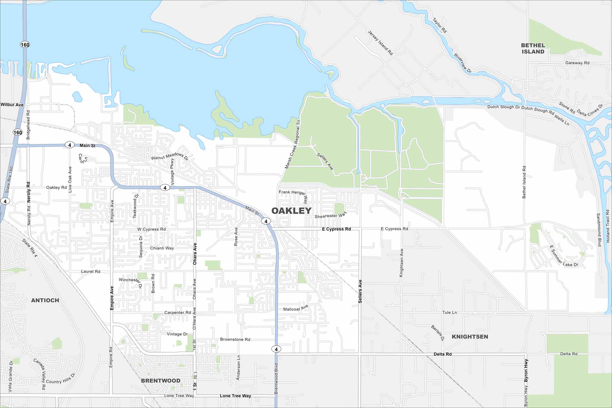
Oakley sits on the edge of the Sacramento–San Joaquin Delta. Our map highlights suburban neighborhoods surrounded by farmland and waterways. Growth has tied it closely to nearby Antioch and Brentwood.
California State Maps
Explore California with our state maps


Map Information
On the Map
Interstates/Highways: State Rte 4, State Rte 160 Major Roads: Main St, Laurel Rd, Cypress Rd, Sellers Ave, Empire Ave, O’Hara Ave, Neroly Rd, Bridgehead Rd, Wilbur Ave, Rose Ave, Knightsen Ave, Bethel Island Rd, Brownstone Rd, Delta Rd, Malicoat Ave, Carpenter Rd, Vintage Dr, Live Oak Ave, Ohara Ave, Tule Ln Lakes and Reservoirs: Summer Lake Nearby Communities: Antioch, Brentwood, Knightsen, Bethel IslandCalifornia City Maps
Here are detailed maps of California


