Map of Oconomowoc, Wisconsin
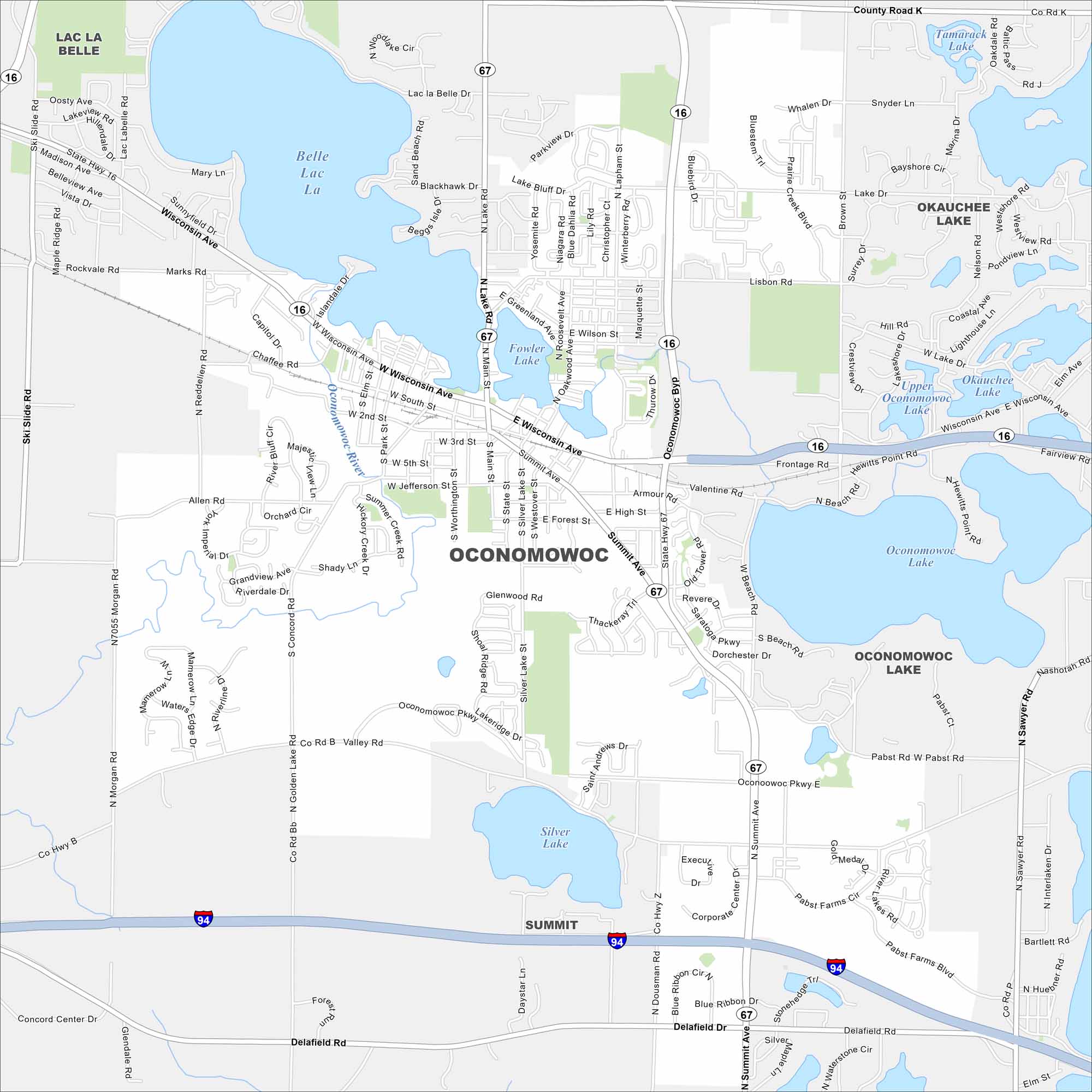
Our map of Oconomowoc highlights a small city surrounded by lakes. The downtown sits between Fowler Lake and Lac La Belle. Water features shape much of the layout.
Map Information
On the Map
Interstates/Highways: I-94, State Rte 16, State Rte 67 Major Roads: Wisconsin Ave, Summit Ave, Main St, Oconomowoc Pkwy, Pabst Rd, Delafield Rd, Valley Rd, Lisbon Rd, Silver Lake St, Lapham St, Lake Rd, High St, Worthington St, Concord Rd, Golden Lake Rd, Morgan Rd, Dousman Rd, Armour Rd, Jefferson St, South St Lakes and Reservoirs: Lac La Belle, Oconomowoc Lake, Silver Lake, Okauchee Lake, Upper Oconomowoc Lake, Tamarack Lake Major Rivers: Oconomowoc River Nearby Communities: Summit, Lac La BelleWisconsin State Maps
Discover maps of the Badger State.


City Maps of Wisconsin
See our Wisconsin maps designed for clarity.


