Map of Ontario, California
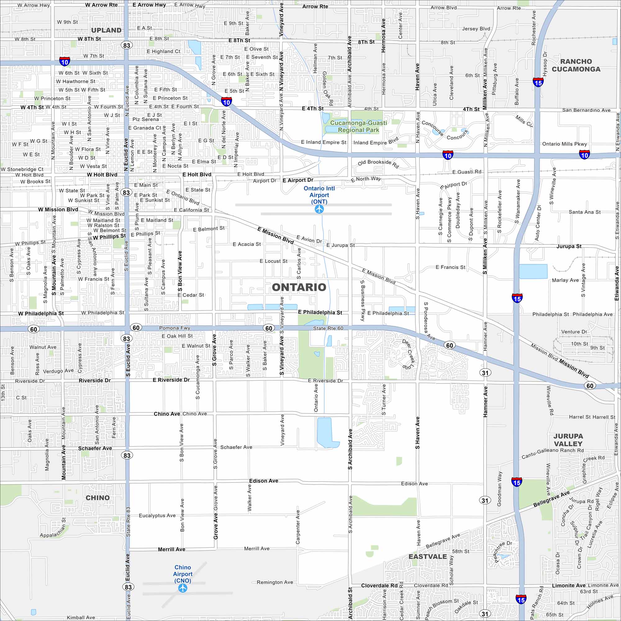
Take a look at Ontario, part of the Inland Empire. This map shows freeways, airports, streets and suburban neighborhoods. Ontario International Airport stands out as a major feature.
California State Maps
Explore California with our state maps


Map Information
On the Map
Interstates/Highways: I-10, I-15, State Rte 60, State Rte 83 Major Roads: Euclid Ave, Archibald Ave, Vineyard Ave, Milliken Ave, Mission Blvd, Holt Blvd, Ontario Mills Pkwy, Haven Ave, Philadelphia St, Riverside Dr, Chino Ave, Edison Ave, Merrill Ave, Fourth St, Mountain Ave, San Bernardino Ave, Jurupa St, Francis St, Grove Ave, Hamner Ave Airports: Ontario Intl Airport (ONT), Chino Airport (CNO) Parks and Preserves: Cucamonga-Guasti Regional Park Nearby Communities: Upland, Rancho Cucamonga, Chino, Jurupa Valley, EastvaleCalifornia City Maps
Here are detailed maps of California


