Map of Palo Alto, California
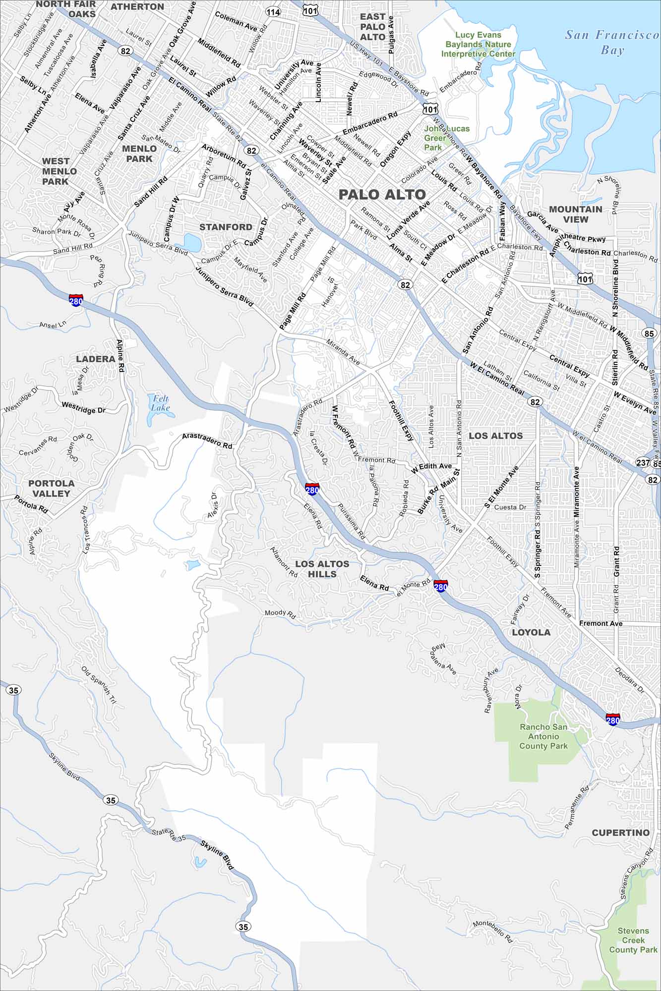
Our map of Palo Alto highlights a city in the heart of Silicon Valley. Stanford University anchors the area, with neighborhoods spreading outward. The bay lies to the east, while foothills rise to the west.
California State Maps
Explore California with our state maps


Map Information
On the Map
Interstates/Highways: US Hwy 101, I-280, State Rte 82, State Rte 114, State Rte 35, State Rte 85, State Rte 237, Oregon Expy, Central Expy Major Roads: El Camino Real, Embarcadaro Rd, Page Mill Rd, Middlefield Rd, Alma St, University Ave, Foothill Expy, Junipero Serra Blvd, Sand Hill Rd, Arastradero Rd, Charleston Rd, San Antonio Rd, Shoreline Blvd, Skyline Blvd, Santa Cruz Ave, Valparaiso Ave, Arboretum Rd, Alpine Rd Lakes and Reservoirs: San Francisco Bay, Felt Lake Parks and Preserves: Rancho San Antonio County Park, Stevens Creek County Park, Lucy Evans Baylands Nature Interpretive Center, John Lucas Greer Park Nearby Communities: East Palo Alto, Menlo Park, Stanford, Mountain View, Los Altos, Los Altos Hills, Portola Valley, Ladera, Loyola, Cupertino, AthertonCalifornia City Maps
Here are detailed maps of California


