Map of Point Pleasant Borough, New Jersey
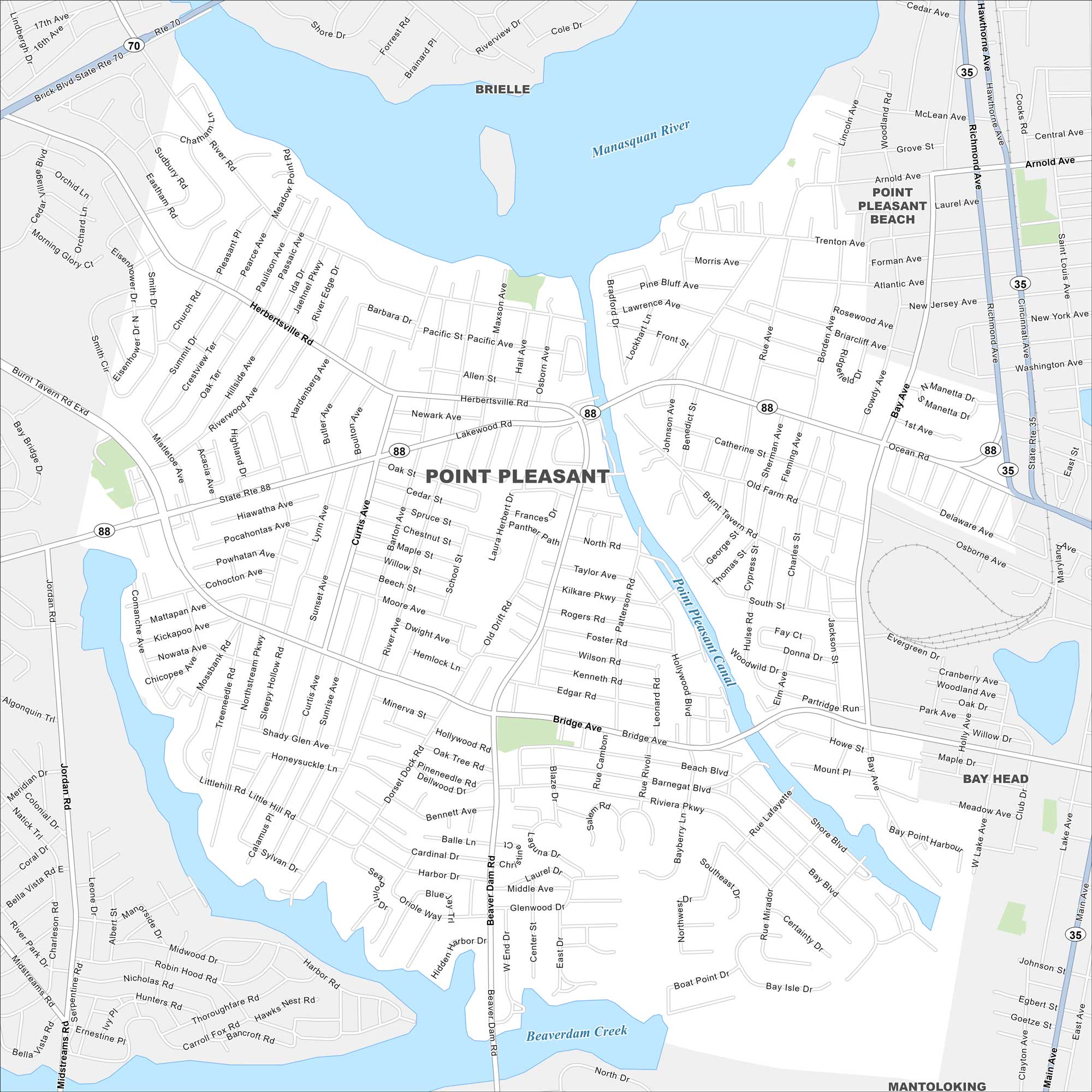
Point Pleasant borough lies at the junction of the Manasquan River and Barnegat Bay. Our map makes the shore, boardwalk, and neighborhood streets easy to follow. Boating and beach life define the area.
Map Information
On the Map
Interstates/Highways: State Rte 88, State Rte 70, State Rte 35 Major Roads: Bridge Ave, Beaver Dam Rd, Herbertsville Rd, River Rd, Ocean Rd, Hollywood Blvd, Jordan Rd, Curtis Ave, Richmond Ave, Bay Ave, Midstreams Rd, Route 88, Route 70, Route 35, Arnold Ave, Trenton Ave, Forman Ave, Atlantic Ave, New Jersey Ave, Shore Blvd Major Rivers: Manasquan River, Point Pleasant Canal, Beaverdam Creek Nearby Communities: Brielle, Point Pleasant Beach, Bay Head, MantolokingNew Jersey State Maps
Explore maps from the Garden State.


City Maps of New Jersey
Newark and New Jersey cities in complete detail


