Map of Port Washington, Wisconsin
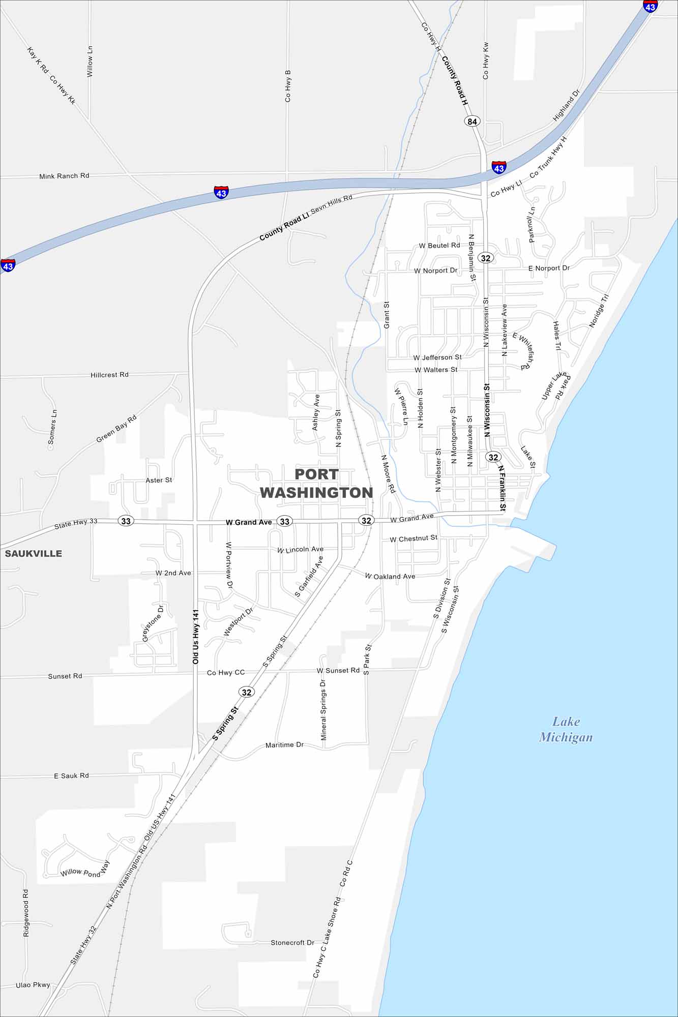
Our map of Port Washington highlights its streets along Lake Michigan. The downtown hugs the waterfront with marinas and historic buildings. The lighthouse stands out as a landmark on the shoreline.
Map Information
On the Map
Interstates/Highways: I-43, US Hwy 141, State Rte 32, State Rte 33 Major Roads: Grand Ave, Wisconsin St, Spring St, Division St, Moore Rd, Sunset Rd, Sauk Rd, Norport Dr, Beutel Rd, Walters St, Jefferson St, Lincoln Ave, Chestnut St, Oakland Ave, Port Washington Rd, Maritime Dr, Mineral Springs Dr, Highland Dr, Parknoll Ln, Hales Trl Lakes and Reservoirs: Lake Michigan Nearby Communities: SaukvilleWisconsin State Maps
Discover maps of the Badger State.


City Maps of Wisconsin
See our Wisconsin maps designed for clarity.


