Map of Racine, Wisconsin
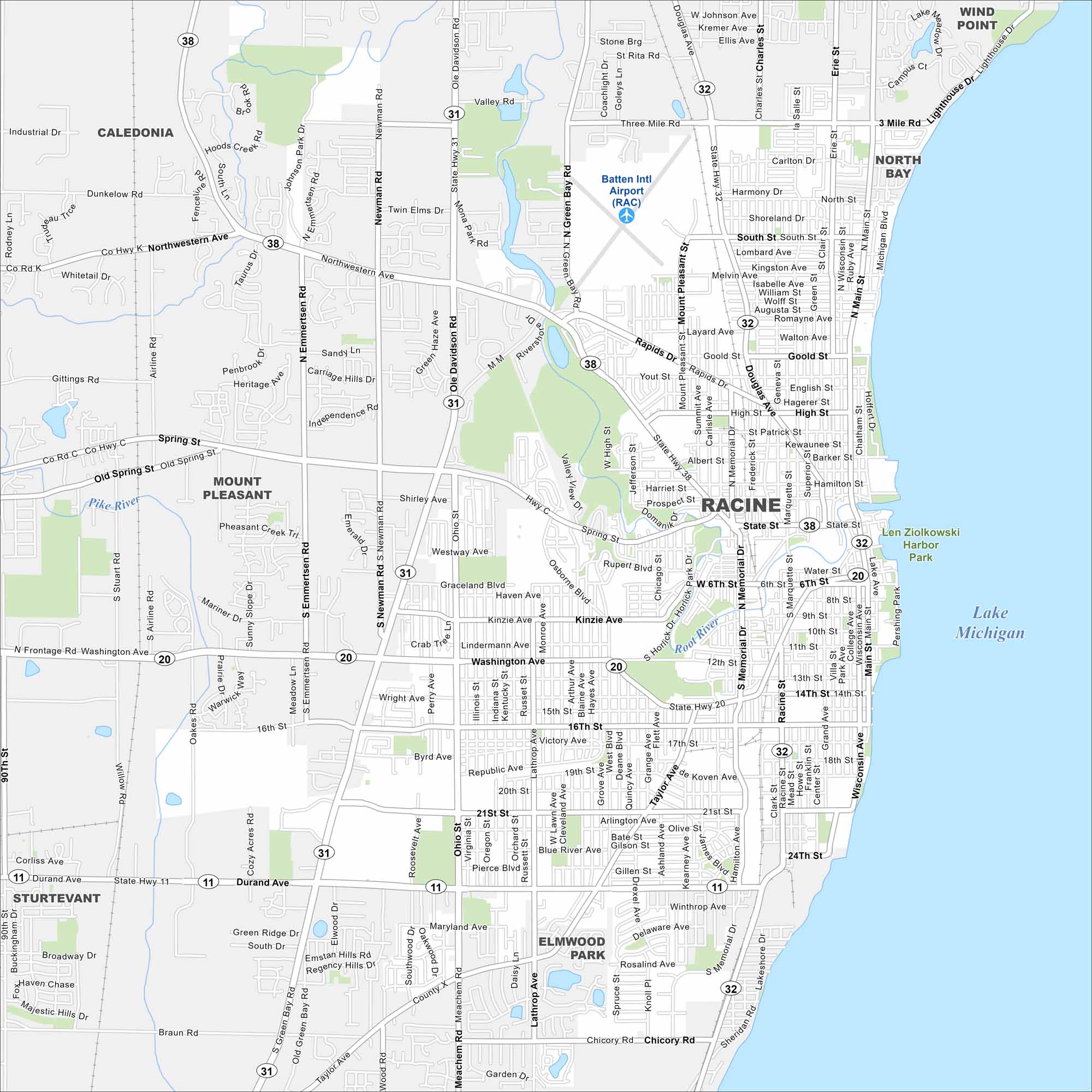
Racine lies on the shores of Lake Michigan. Our map lays out the city grid along the lakefront and beyond. The Danish pastry known as kringle is a local specialty here.
Map Information
On the Map
Interstates/Highways: State Rte 11, State Rte 20, State Rte 31, State Rte 32, State Rte 38 Major Roads: Washington Ave, Main St, State St, Durand Ave, Douglas Ave, Taylor Ave, Lathrop Ave, Memorial Dr, 16th St, 21st St, Spring St, Northwestern Ave, Ohio St, Green Bay Rd, Meachem Rd, Braun Rd, Chicory Rd, High St, Goold St, Rapids Dr Airports: Batten Intl Airport (RAC) Lakes and Reservoirs: Lake Michigan Major Rivers: Root River, Pike River Parks and Preserves: Len Ziolkowski Harbor Park Nearby Communities: Caledonia, Wind Point, North Bay, Mount Pleasant, Sturtevant, Elmwood ParkWisconsin State Maps
Discover maps of the Badger State.


City Maps of Wisconsin
See our Wisconsin maps designed for clarity.


