Map of Rancho Cordova, California
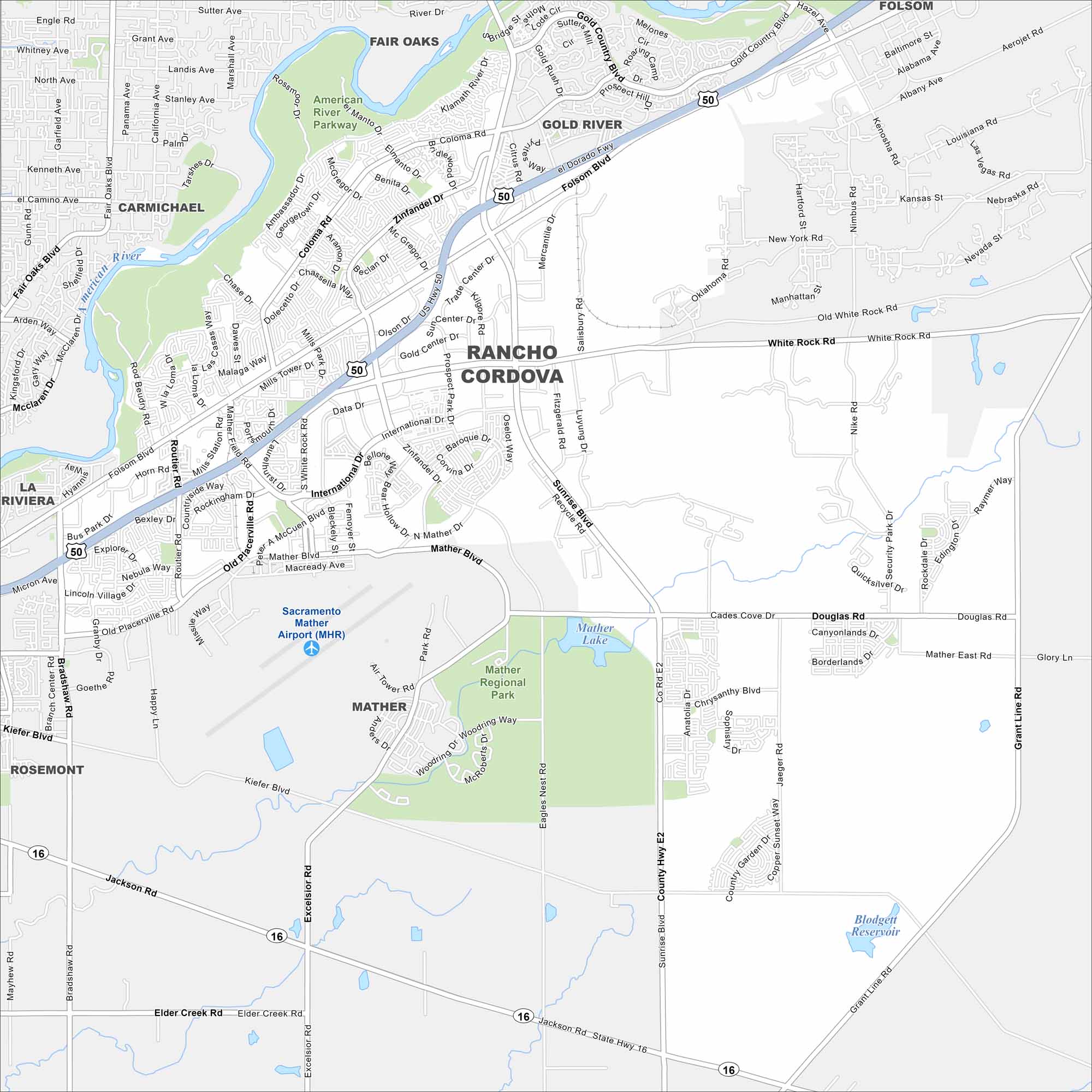
Our map of Rancho Cordova shows the business parks, neighborhoods, and main corridors. The city lies just east of Sacramento. It’s a hub for cycling trails and outdoor recreation along the American River.
California State Maps
Explore California with our state maps


Map Information
On the Map
Interstates/Highways: US Hwy 50, State Hwy 16 Major Roads: Sunrise Blvd, Folsom Blvd, Zinfandel Dr, White Rock Rd, Mather Blvd, Douglas Rd, Grant Line Rd, Coloma Rd, International Dr, Kiefer Blvd, Bradshaw Rd, Old Placerville Rd, Jackson Rd, Kilgore Rd, Excelsior Rd, Aerojet Rd, Security Park Rd, Mather East Rd, Data Dr, Gold Country Blvd Airports: Sacramento Mather Airport (MHR) Lakes and Reservoirs: Mather Lake, Blodgett Reservoir Major Rivers: American River Parks and Preserves: Mather Regional Park, American River Parkway Nearby Communities: Carmichael, Fair Oaks, Gold River, Folsom, Rosemont, La RivieraCalifornia City Maps
Here are detailed maps of California


