Map of Rialto, California
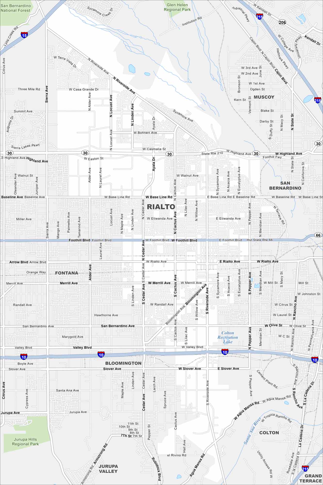
Set in San Bernardino County, Rialto offers both city life and mountain views. Our road map shows the routes that connect all its neighborhoods. The city is also home to a historic stretch of Route 66.
California State Maps
Explore California with our state maps


Map Information
On the Map
Interstates/Highways: I-10, I-15, I-215, State Rte 210, State Rte 30, State Rte 66 Major Roads: Foothill Blvd, Valley Blvd, Riverside Ave, Baseline Rd, Rialto Ave, Merrill Ave, San Bernardino Ave, Highland Ave, Cedar Ave, Cactus Ave, Willow Ave, Pepper Ave, Sierra Ave, Linden Ave, Bloomington Ave, Slover Ave, Jurupa Ave, Agua Mansa Rd, Easton St, Walnut Ave Lakes and Reservoirs: Colton Recreation Lake Major Rivers: Santa Ana River Parks and Preserves: San Bernardino National Forest, Glen Helen Regional Park, Jurupa Hills Regional Park Nearby Communities: Rialto, Fontana, San Bernardino, Muscoy, Bloomington, Colton, Grand TerraceCalifornia City Maps
Here are detailed maps of California


