Map of Richmond, California
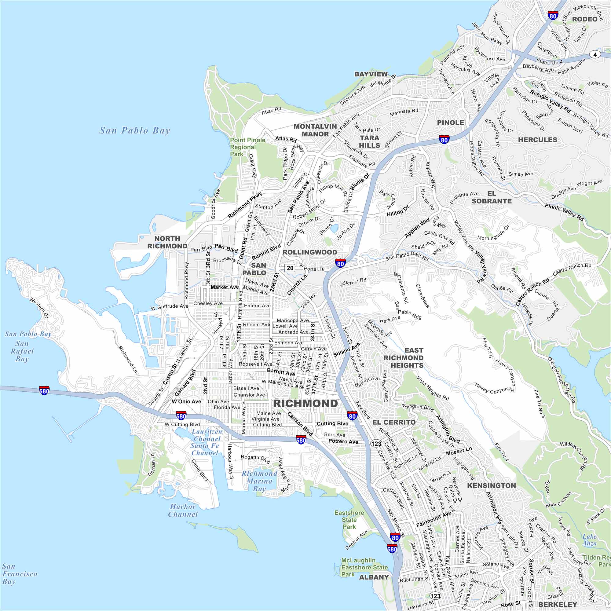
Right on San Francisco Bay, Richmond combines waterfront industry with lively neighborhoods. Our map points out the key routes through downtown and the shoreline.
California State Maps
Explore California with our state maps


Map Information
On the Map
Interstates/Highways: I-80, I-580, State Rte 123, State Rte 4, State Rte 20 Major Roads: Richmond Pkwy, Cutting Blvd, San Pablo Ave, Castro St, Garrard Blvd, Macdonald Ave, Carlson Blvd, Appian Way, Hilltop Dr, Atlas Rd, Giant Hwy, Rumrill Rd, Market Ave, Barrett Ave, Solano Ave, McBryde Ave, Valley View Rd, Pinole Valley Rd, Dam Rd, Arlington Blvd Lakes and Reservoirs: San Pablo Bay, San Francisco Bay, San Rafael Bay, Richmond Marina Bay, Santa Fe Channel, Lauritzen Channel, Harbor Channel, Lake Anza Parks and Preserves: Point Pinole Regional Park, Eastshore State Park, McLaughlin Eastshore State Park, Tilden Regional Park Nearby Communities: Richmond, North Richmond, San Pablo, Rollingwood, Montalvin Manor, Tara Hills, Bayview, Pinole, Hercules, El Sobrante, East Richmond Heights, El Cerrito, Kensington, Albany, Berkeley, RodeoCalifornia City Maps
Here are detailed maps of California


