Map of Ridgewood, New Jersey
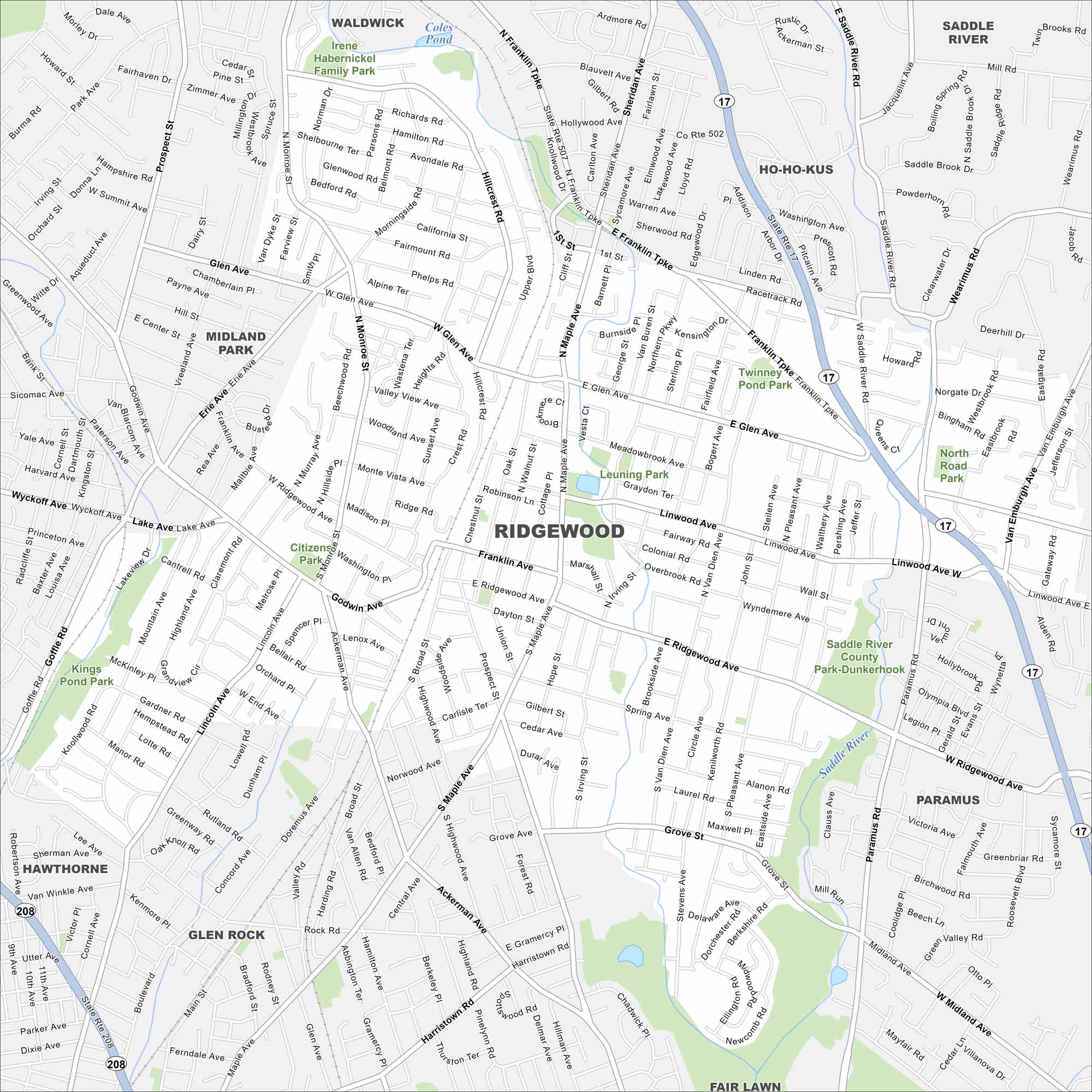
Here’s our road map of Ridgewood highlighting the downtown and surrounding streets. You can see the railway and parks that define the community.
Map Information
On the Map
Interstates/Highways: State Rte 17, State Rte 208 Major Roads: Franklin Ave, Ridgewood Ave, Maple Ave, Glen Ave, Linwood Ave, Goffle Rd, Godwin Ave, Grove St, Paramus Rd, Wyckoff Ave, W Ridgewood Ave, E Ridgewood Ave, Prospect St, Northern Pkwy, Ackerman Ave, Harristown Rd, Lincoln Ave, Doremus Ave, Saddle River Rd, Fairmount Rd Lakes and Reservoirs: Coles Pond Major Rivers: Saddle River Parks and Preserves: Irene Habernickel Family Park, Twinney Pond Park, Leuning Park, Citizens Park, Kings Pond Park, Saddle River County Park-Dunkerhook, North Road Park Nearby Communities: Waldwick, Saddle River, Ho-Ho-Kus, Paramus, Fair Lawn, Glen Rock, Hawthorne, Midland ParkNew Jersey State Maps
Explore maps from the Garden State.


City Maps of New Jersey
Newark and New Jersey cities in complete detail


