Map of Rosemead, California
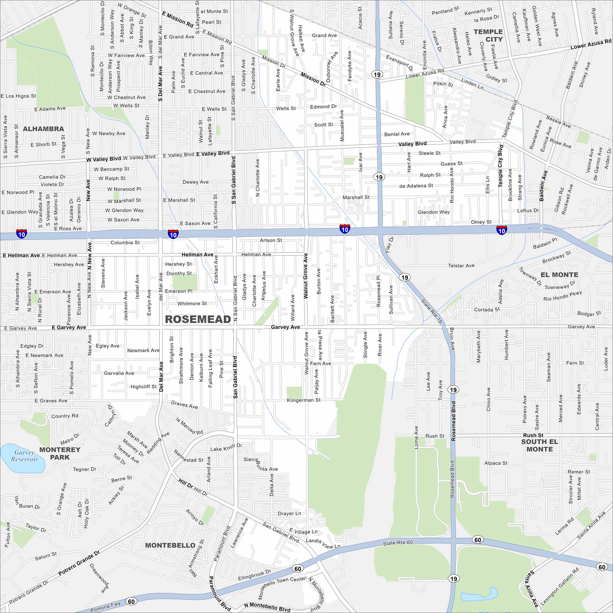
Our map of Rosemead highlights the main streets and local neighborhoods. You’ll spot parks, reservoirs, and easy routes into Los Angeles. It’s your guide to this San Gabriel Valley city.
California State Maps
Explore California with our state maps


Map Information
On the Map
Interstates/Highways: I-10, State Rte 19, State Rte 60 Major Roads: Valley Blvd, Garvey Ave, Rosemead Blvd, San Gabriel Blvd, Mission Rd, Hellman Ave, Walnut Grove Ave, Del Mar Ave, New Ave, Marshall St, Emerson Ave, Whitmore St, Klingerman St, Rush St, Potrero Grande Dr, Paramount Blvd, Montebello Blvd, Rio Hondo Pkwy, Townway Dr, Telstar Ave Lakes and Reservoirs: Garvey Reservoir Nearby Communities: Alhambra, Temple City, El Monte, South El Monte, Montebello, Monterey ParkCalifornia City Maps
Here are detailed maps of California


