Map of Roseville, California
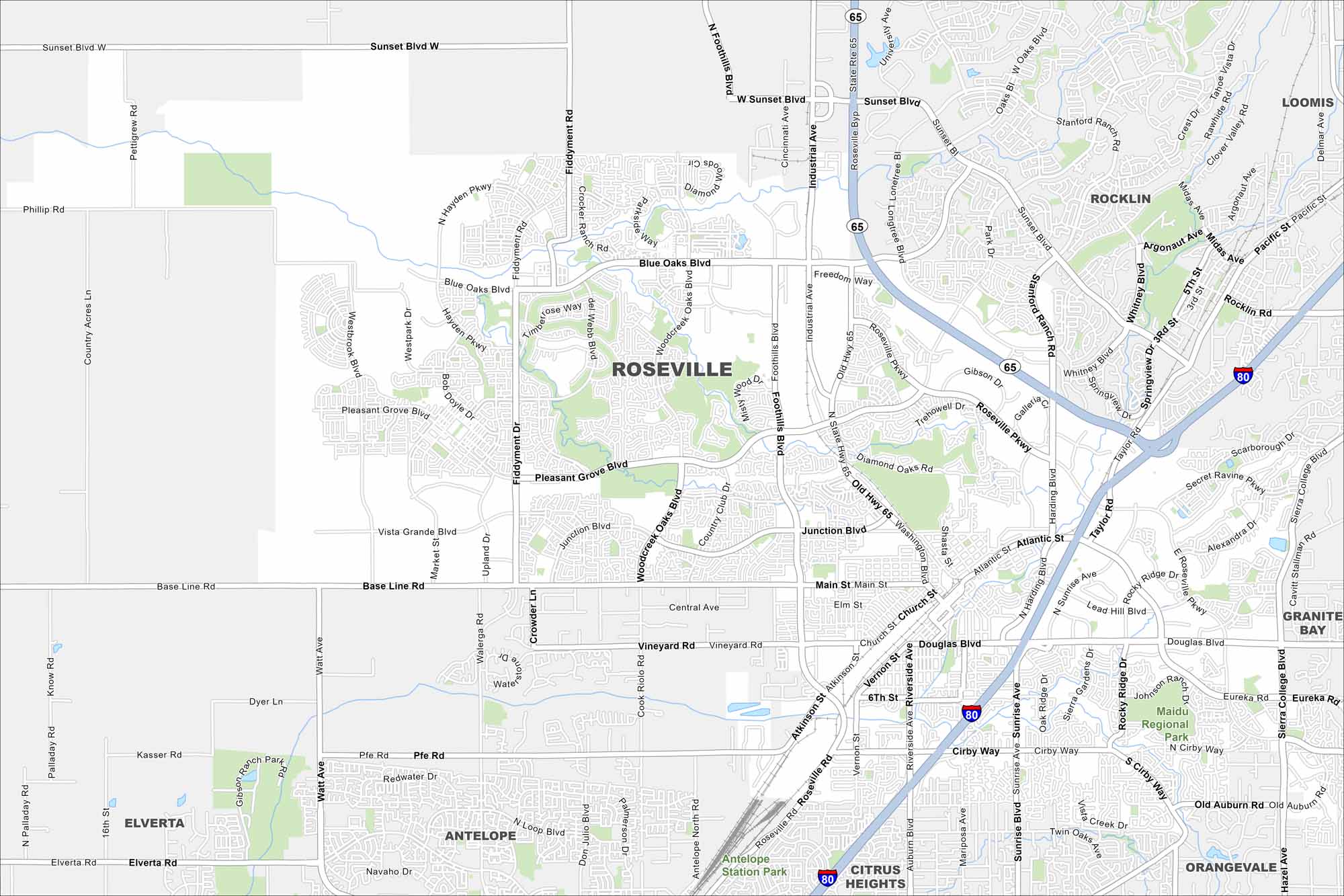
Get oriented with our Roseville map. From shopping districts to residential streets, it shows how everything comes together. Overall, you’ll find your way through this growing Sacramento suburb.
California State Maps
Explore California with our state maps


Map Information
On the Map
Interstates/Highways: I-80, State Rte 65 Major Roads: Douglas Blvd, Sunrise Blvd, Riverside Ave, Foothills Blvd, Blue Oaks Blvd, Pleasant Grove Blvd, Woodcreek Oaks Blvd, Washington Blvd, Main St, Baseline Rd, Junction Blvd, Roseville Pkwy, Industrial Ave, Cirby Way, Eureka Rd, Sierra College Blvd, Watt Ave, Pfe Rd, Walerga Rd, Sunset Blvd Parks and Preserves: Maidu Regional Park Nearby Communities: Rocklin, Loomis, Granite Bay, Orangevale, Citrus Heights, Antelope, ElvertaCalifornia City Maps
Here are detailed maps of California


