Map of Sacramento, California
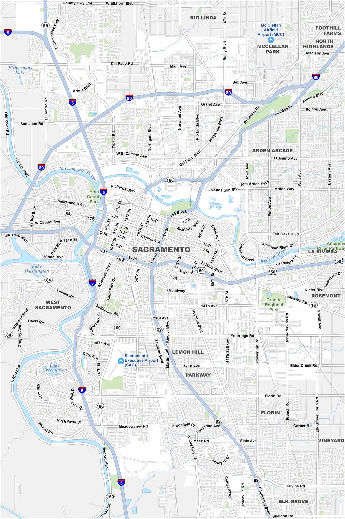
This street map of Sacramento shows the Capitol and the streets around it. Our map highlights the grid downtown and the riverfront. It’s the heart of California with plenty to explore.
California State Maps
Explore California with our state maps


Map Information
On the Map
Interstates/Highways: I-5, I-80, US Hwy 50, US Hwy 99, State Rte 16, State Rte 51, State Rte 84, State Rte 160 Major Roads: Capitol Ave, Broadway, Freeport Blvd, Stockton Blvd, Folsom Blvd, Florin Rd, Mack Rd, Meadowview Rd, Pocket Rd, Richards Blvd, J St, Garden Hwy, Northgate Blvd, Truxel Rd, Arden Way, Howe Ave, Watt Ave, Fruitridge Rd, Power Inn Rd, 65th St Expy Airports: Sacramento Executive Airport (SAC), McClellan Airfield Airport (MCC) Lakes and Reservoirs: Fishermans Lake, Lake Washington, Lake Greenhaven Major Rivers: Sacramento River, American River Parks and Preserves: Yolo County Park, Granite Regional Park, Miller Regional Park Nearby Communities: Rio Linda, North Highlands, Foothill Farms, Arden-Arcade, La Riviera, Rosemont, Lemon Hill, Florin, Parkway, Vineyard, Elk Grove, West Sacramento Neighborhoods: Downtown SacramentoCalifornia City Maps
Here are detailed maps of California


