Map of Salinas, California
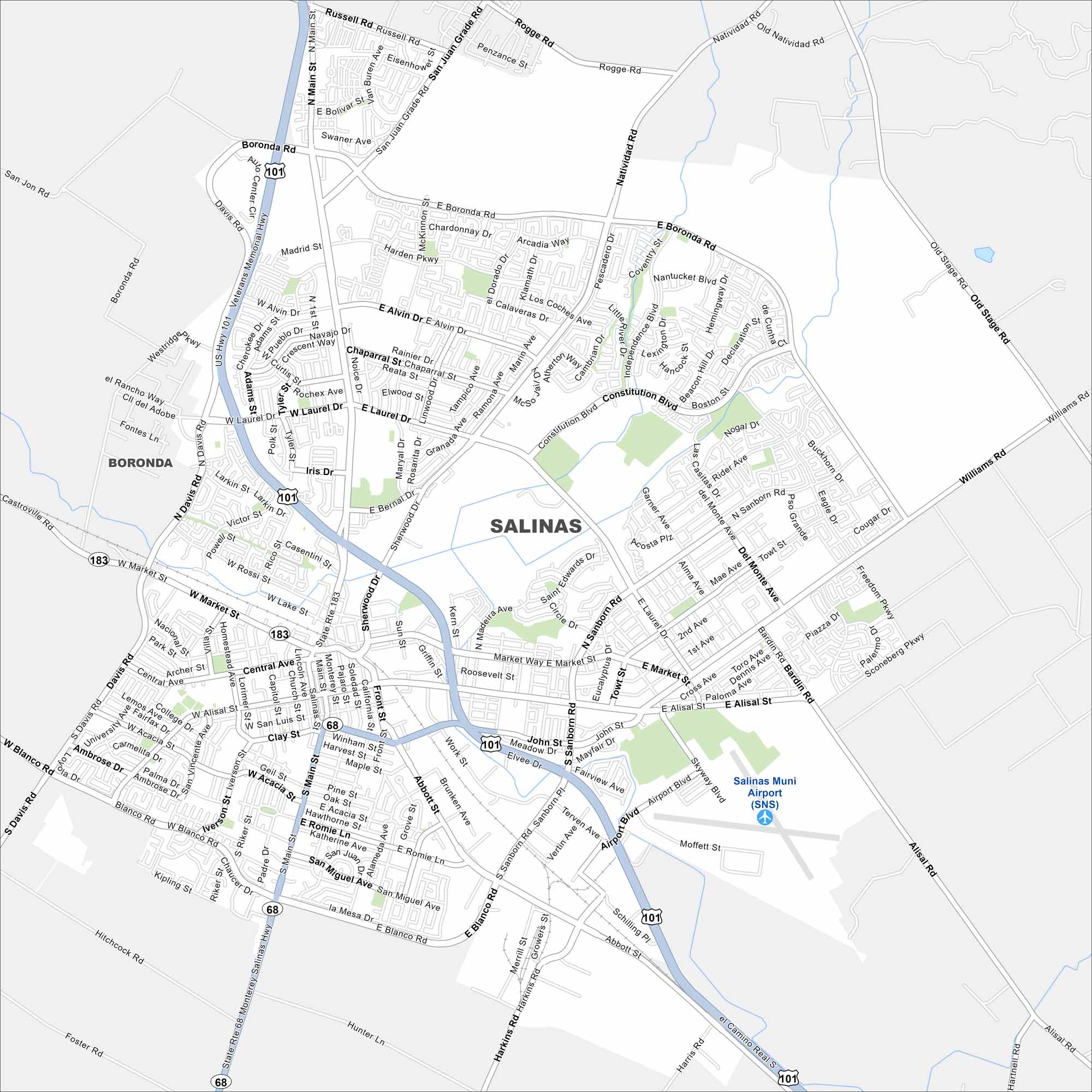
Our map of Salinas highlights the downtown grid and the fields that stretch beyond it. It’s a city with strong farming roots. Get your bearings quickly with our road map of the city.
California State Maps
Explore California with our state maps


Map Information
On the Map
Interstates/Highways: US Hwy 101, State Rte 68, State Rte 183 Major Roads: Main St, Market St, Sanborn Rd, E Alisal St, W Alisal St, Blanco Rd, Boronda Rd, Constitution Blvd, Natividad Rd, Davis Rd, Abbott St, Williams Rd, John St, Laurel Dr, Rossi St, Romie Ln, San Miguel Ave, Airport Blvd, Harris Rd, Spreckels Blvd Airports: Salinas Muni Airport (SNS) Nearby Communities: BorondaCalifornia City Maps
Here are detailed maps of California


