Map of San Bernardino, California
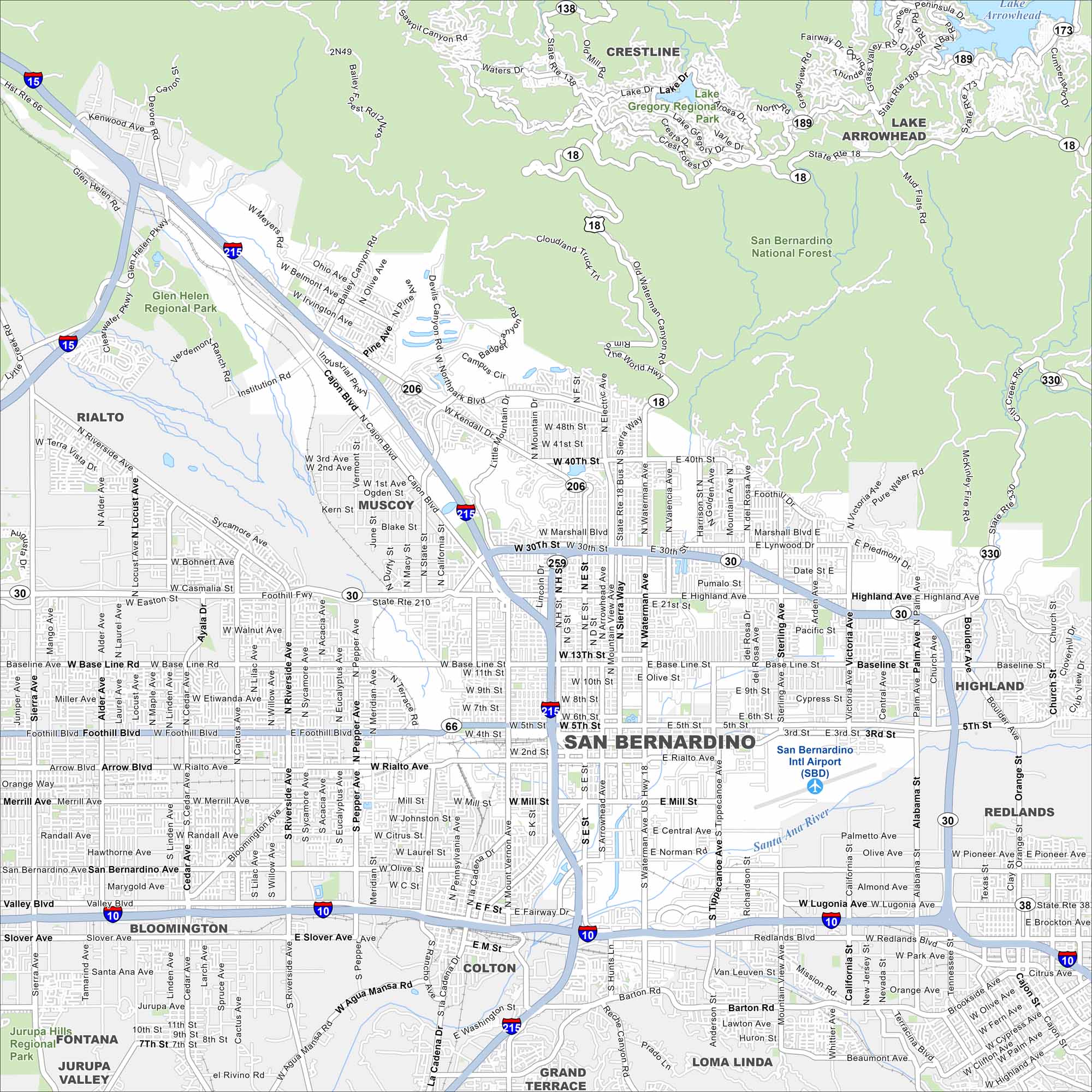
Here’s our map of San Bernardino with its downtown, airport, and mountain access. It’s a guide to a city at the base of the San Bernardinos.
California State Maps
Explore California with our state maps


Map Information
On the Map
Interstates/Highways: I-15, I-215, I-10, State Rte 210, State Rte 18, State Rte 138, State Rte 66, State Rte 330, State Rte 30, State Rte 189, State Rte 173, State Rte 38 Major Roads: Baseline Rd, Foothill Blvd, Highland Ave, Mill St, Waterman Ave, Tippecanoe Ave, San Bernardino Ave, Valley Blvd, Slover Ave, Sierra Way, Arrowhead Ave, Mt Vernon Ave, Cajon Blvd, University Pkwy, Del Rosa Ave, Sterling Ave, Victoria Ave, Alabama St, Lugonia Ave, Orange Show Rd Airports: San Bernardino Intl Airport (SBD) Lakes and Reservoirs: Lake Gregory, Lake Arrowhead Major Rivers: Santa Ana River Parks and Preserves: San Bernardino National Forest, Glen Helen Regional Park, Jurupa Hills Regional Park Nearby Communities: Rialto, Muscoy, Colton, Loma Linda, Redlands, Highland, Crestline, Bloomington, Fontana, Grand TerraceCalifornia City Maps
Here are detailed maps of California


