Map of San Mateo, California
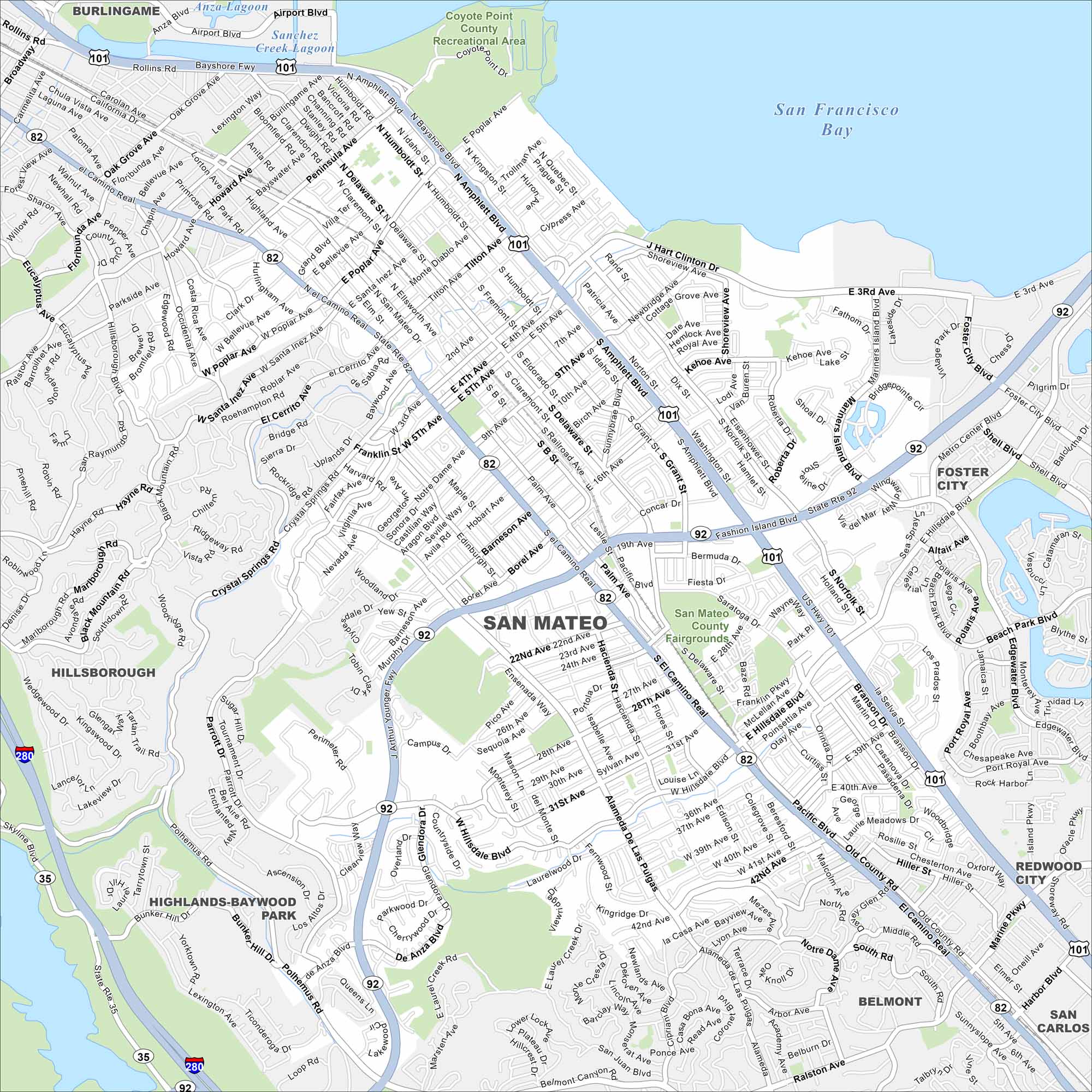
San Mateo is tucked along the Bay with a busy downtown and easy access to trails. See how San Mateo, California is connected with our map.
California State Maps
Explore California with our state maps


Map Information
On the Map
Interstates/Highways: US Hwy 101, State Rte 92, State Rte 82, I-280 Major Roads: El Camino Real, Hillsdale Blvd, Delaware St, Norfolk St, 3rd Ave, 4th Ave, 9th Ave, 25th Ave, 31st Ave, 42nd Ave, Alameda de las Pulgas, Crystal Springs Rd, Campus Dr, Polhemus Rd, Peninsula Ave, J Hart Clinton Dr, Shoreview Ave, Borel Ave, West Hillsdale Blvd, De Anza Blvd Lakes and Reservoirs: San Francisco Bay, Sanchez Creek Lagoon, Anza Lagoon Parks and Preserves: Coyote Point County Recreational Area, San Mateo County Fairgrounds Nearby Communities: Burlingame, Hillsborough, Foster City, Belmont, San Carlos, Redwood CityCalifornia City Maps
Here are detailed maps of California


