Map of San Rafael, California
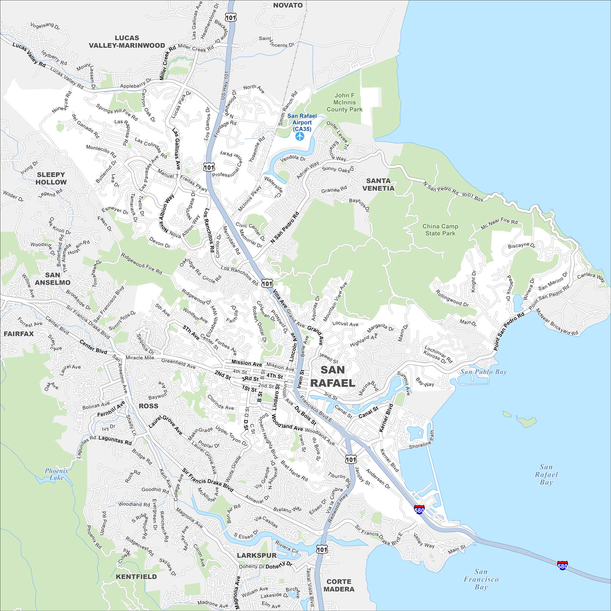
Our map helps you move through San Rafael, California. Start at the historic downtown, then head out toward the Marin hills or the waterfront.
California State Maps
Explore California with our state maps


Map Information
On the Map
Interstates/Highways: US Hwy 101, I-580 Major Roads: Sir Francis Drake Blvd, 2nd St, 3rd St, 4th St, Mission Ave, Grand Ave, San Pedro Rd, Francisco Blvd, Irwin St, Lincoln Ave, Point San Pedro Rd, Manuel T Freitas Pkwy, Lucas Valley Rd, Center Blvd, Bellam Blvd, Andersen Dr, Main St, Medway Rd, Kerner Blvd, Canal St Airports: San Rafael Airport (CA35) Lakes and Reservoirs: San Pablo Bay, San Francisco Bay, San Rafael Bay, Phoenix Lake Parks and Preserves: China Camp State Park, John F McInnis County Park Nearby Communities: Novato, Lucas Valley-Marinwood, Santa Venetia, Sleepy Hollow, San Anselmo, Fairfax, Ross, Kentfield, Larkspur, Corte MaderaCalifornia City Maps
Here are detailed maps of California


