Map of San Ramon, California
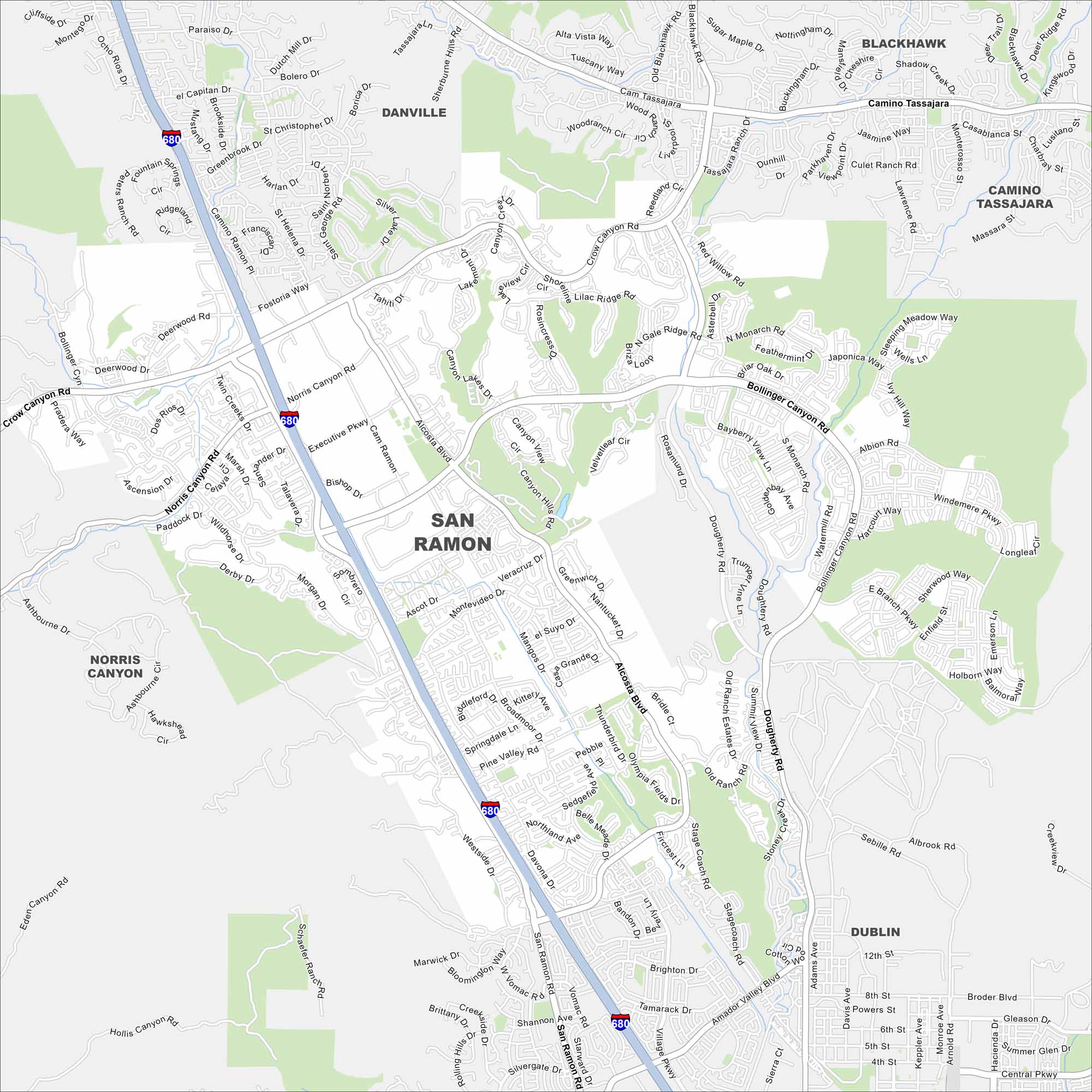
Our map of San Ramon shows you how the neighborhoods, offices, and open spaces come together. It’s a city that keeps growing.
California State Maps
Explore California with our state maps


Map Information
On the Map
Interstates/Highways: I-680 Major Roads: San Ramon Valley Blvd, Alcosta Blvd, Bollinger Canyon Rd, Crow Canyon Rd, Norris Canyon Rd, Executive Pkwy, Montevideo Dr, Pine Valley Rd, Dougherty Rd, Old Ranch Rd, Camino Tassajara, Tassajara Rd, Village Pkwy, Davona Dr, Broadmoor Dr, Montgomery St, Bishop Dr, Talavera Dr, Albion Rd, Windemere Pkwy Nearby Communities: Danville, Blackhawk, Camino Tassajara, Norris Canyon, DublinCalifornia City Maps
Here are detailed maps of California


