Map of Santa Barbara, California
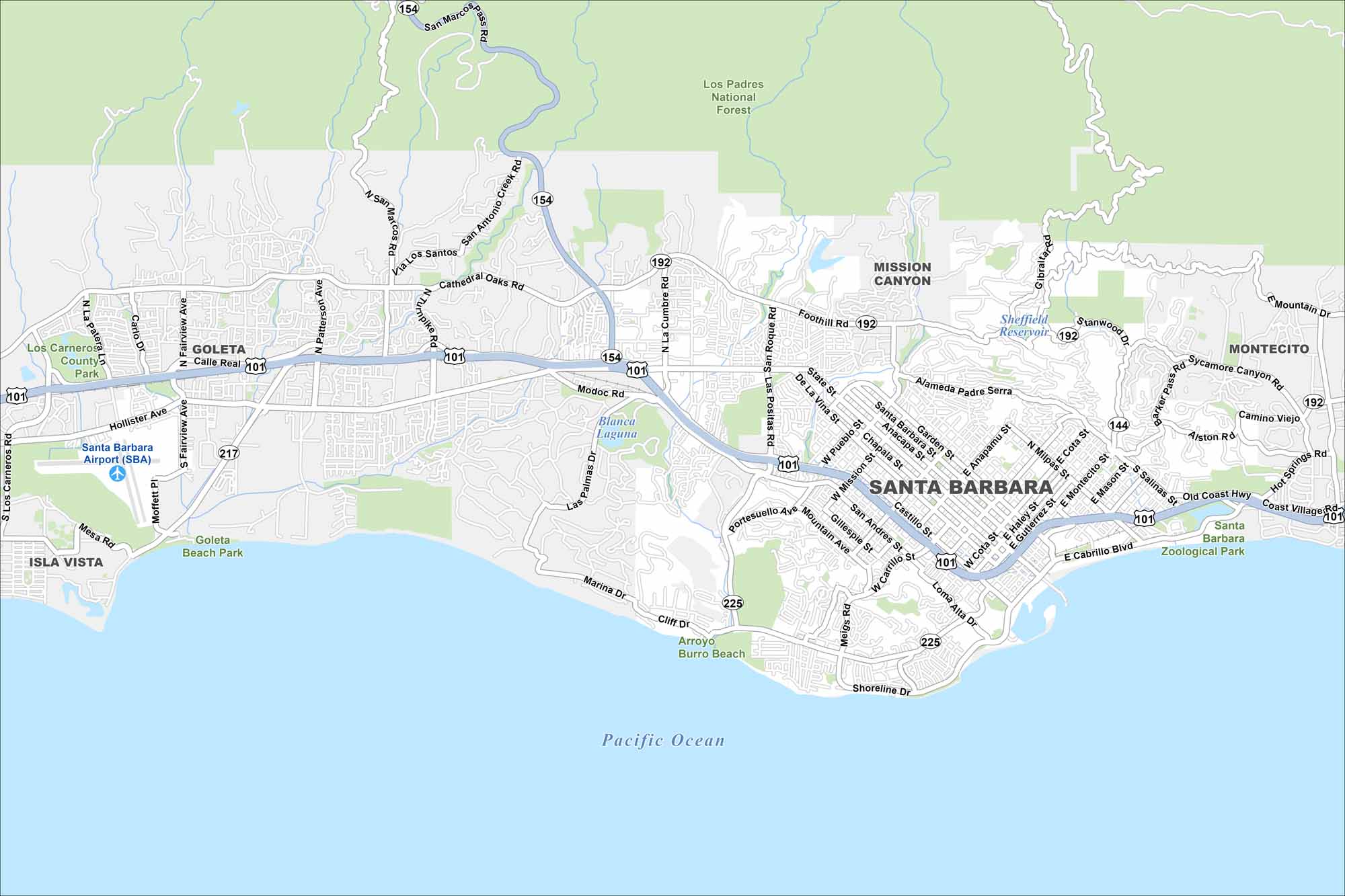
Take a look at our map of Santa Barbara. From the beaches to State Street and the red-tiled hills, it’s a coastal city with a Spanish soul.
California State Maps
Explore California with our state maps


Map Information
On the Map
Interstates/Highways: US Hwy 101, State Rte 154, State Rte 192, State Rte 225, State Rte 144, State Rte 217 Major Roads: State St, Carrillo St, Micheltorena St, Milpas St, Cabrillo Blvd, Cliff Dr, Foothill Rd, Cathedral Oaks Rd, Hollister Ave, Fairview Ave, Patterson Ave, San Marcos Pass Rd, Las Posas Rd, Modoc Rd, Anacapa St, Castillo St, Salinas St, Alameda Padre Serra, Shoreline Dr, Marina Dr Airports: Santa Barbara Airport (SBA) Lakes and Reservoirs: Pacific Ocean, Sheffield Reservoir, Blanca Laguna Parks and Preserves: Los Padres National Forest, Mission Canyon, Santa Barbara Zoological Park, Goleta Beach Park, Los Carneros County Park Nearby Communities: Goleta, Isla Vista, Mission Canyon, MontecitoCalifornia City Maps
Here are detailed maps of California


