Map of Santa Clarita, California
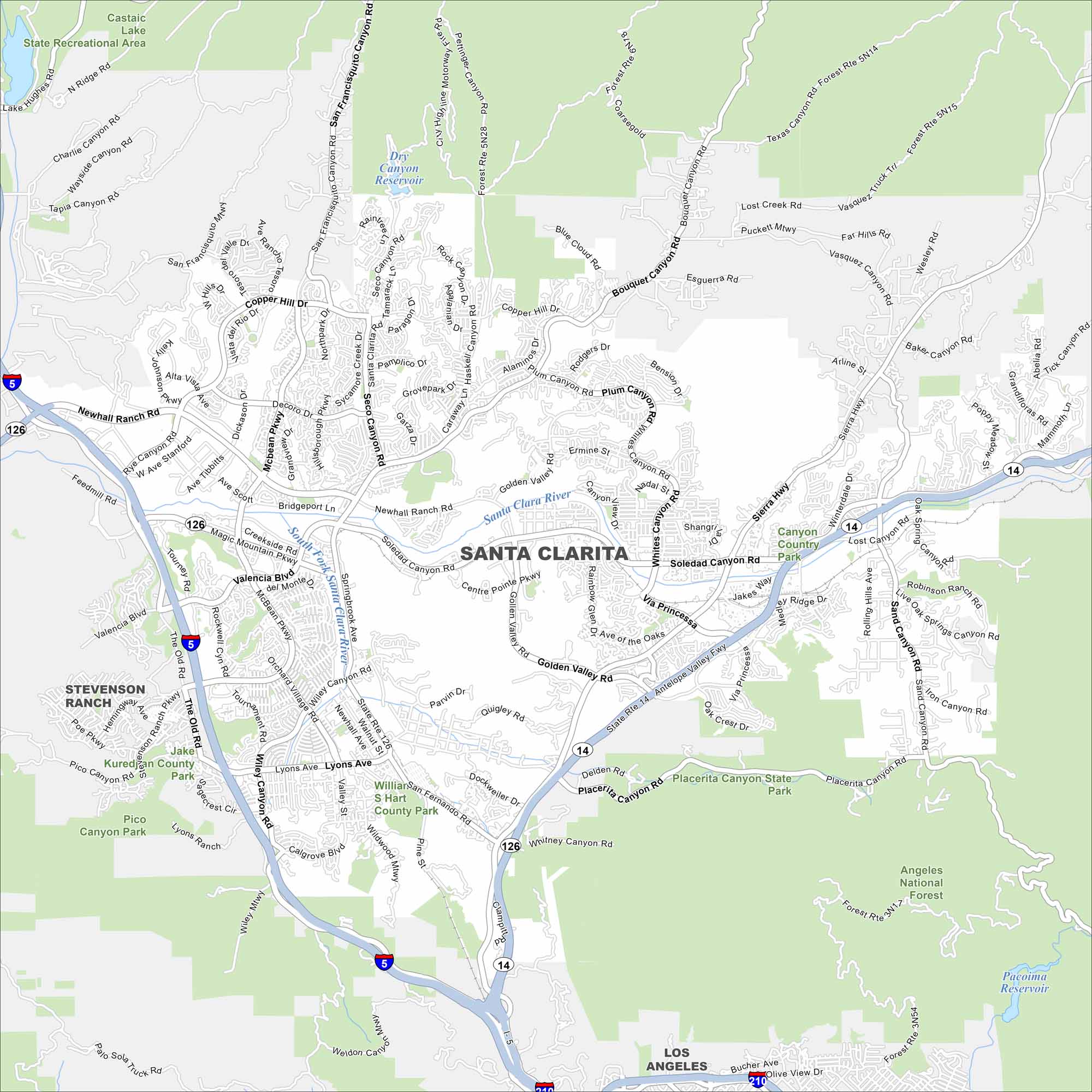
Here’s a map of Santa Clarita, home to Six Flags Magic Mountain and plenty of canyon trails. Our map shows the best routes through this growing city.
California State Maps
Explore California with our state maps


Map Information
On the Map
Interstates/Highways: I-5, State Rte 14, State Rte 126 Major Roads: Newhall Ranch Rd, Golden Valley Rd, Soledad Canyon Rd, Sierra Hwy, Bouquet Canyon Rd, McBean Pkwy, Valencia Blvd, Lyons Ave, San Fernando Rd, Sand Canyon Rd, Whites Canyon Rd, Via Princessa, Copper Hill Dr, Seco Canyon Rd, Haskell Canyon Rd, Plum Canyon Rd, Magic Mountain Pkwy, Tourney Rd, Rockwell Canyon Rd, Orchard Village Rd Lakes and Reservoirs: Castaic Lake, Dry Canyon Reservoir, Pacoima Reservoir Major Rivers: Santa Clara River Parks and Preserves: Angeles National Forest, Placerita Canyon State Park, Castaic Lake State Recreational Area, Pico Canyon Park, Jake Kuredjian County Park, William S Hart County Park Nearby Communities: Stevenson Ranch, Los AngelesCalifornia City Maps
Here are detailed maps of California


