Map of Seaside, California
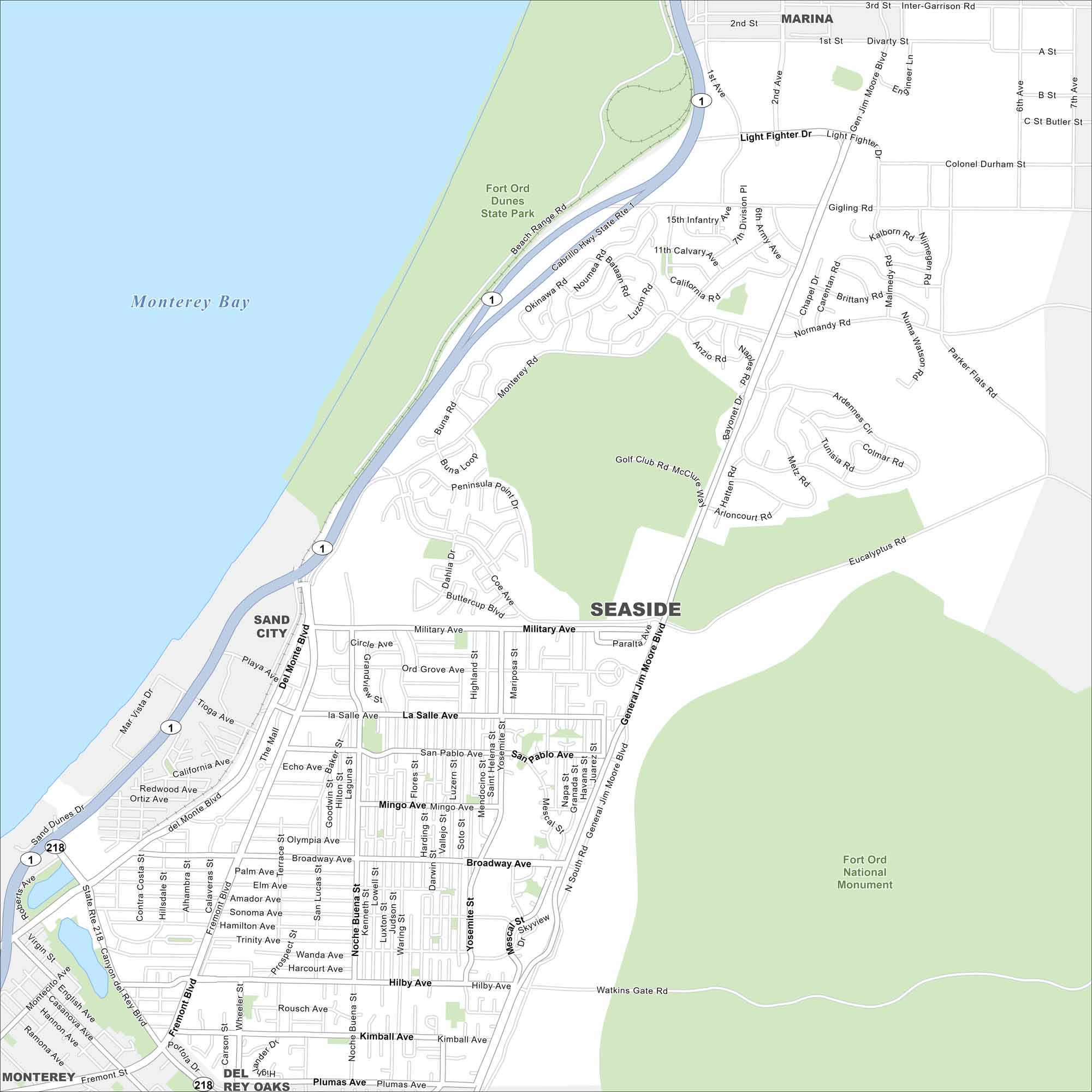
Our map of Seaside shows this Monterey Bay city with its beaches, golf courses, and easy access to coastal trails. It’s a relaxed stop along the California coast.
California State Maps
Explore California with our state maps


Map Information
On the Map
Interstates/Highways: State Rte 1, State Rte 218 Major Roads: General Jim Moore Blvd, Del Monte Blvd, Broadway Ave, Canyon del Rey Blvd, Fremont Blvd, Military Ave, Hilby Ave, Coe Ave, Light Fighter Dr, Mescal St, Noche Buena St, Plumas Ave, Watkins Gate Rd, Eucalyptus Rd, San Pablo Ave Lakes and Reservoirs: Monterey Bay Parks and Preserves: Fort Ord Dunes State Park, Fort Ord National Monument Nearby Communities: Marina, Sand City, Del Rey Oaks, MontereyCalifornia City Maps
Here are detailed maps of California


