Map of Simi Valley, California
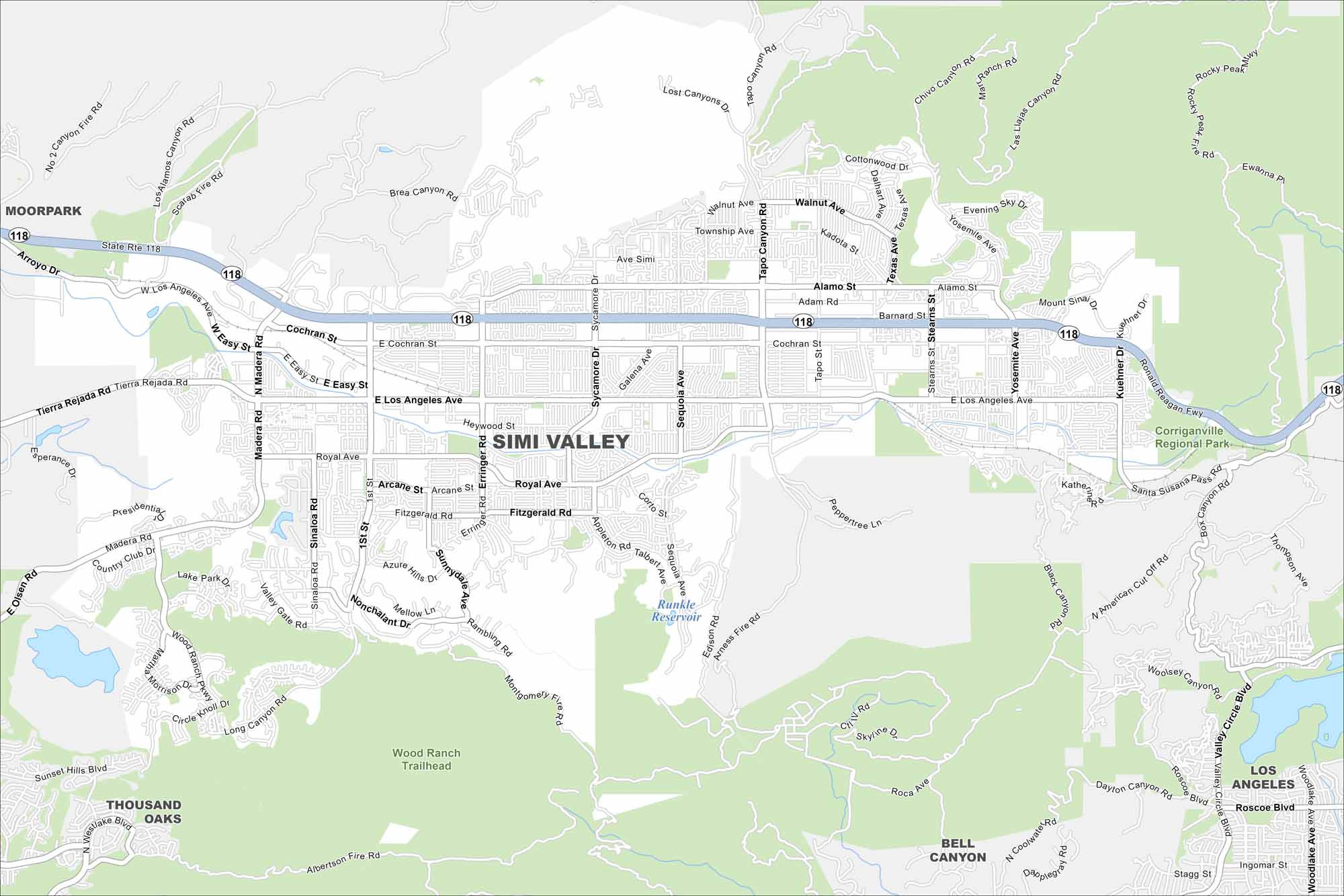
Find your bearings in Simi Valley using our road map. It’s home to suburban neighborhoods, the Reagan Library, and surrounding hills.
California State Maps
Explore California with our state maps


Map Information
On the Map
Interstates/Highways: State Rte 118 Major Roads: Los Angeles Ave, Stearns St, Tapo Canyon Rd, Sycamore Dr, Madera Rd, First St, Erringer Rd, Royal Ave, Cochran St, Yosemite Ave, Kuehner Dr, Tierra Rejada Rd, Alamo St, Sequoia Ave, Galena Ave, Fitzgerald Rd, Easy St, Black Canyon Rd, Long Canyon Rd Lakes and Reservoirs: Runkle Reservoir, Bard Reservoir Parks and Preserves: Corriganville Regional Park, Wood Ranch Trailhead Nearby Communities: Moorpark, Thousand Oaks, Bell Canyon, Los AngelesCalifornia City Maps
Here are detailed maps of California


