Massachusetts National Parks and Forests Map
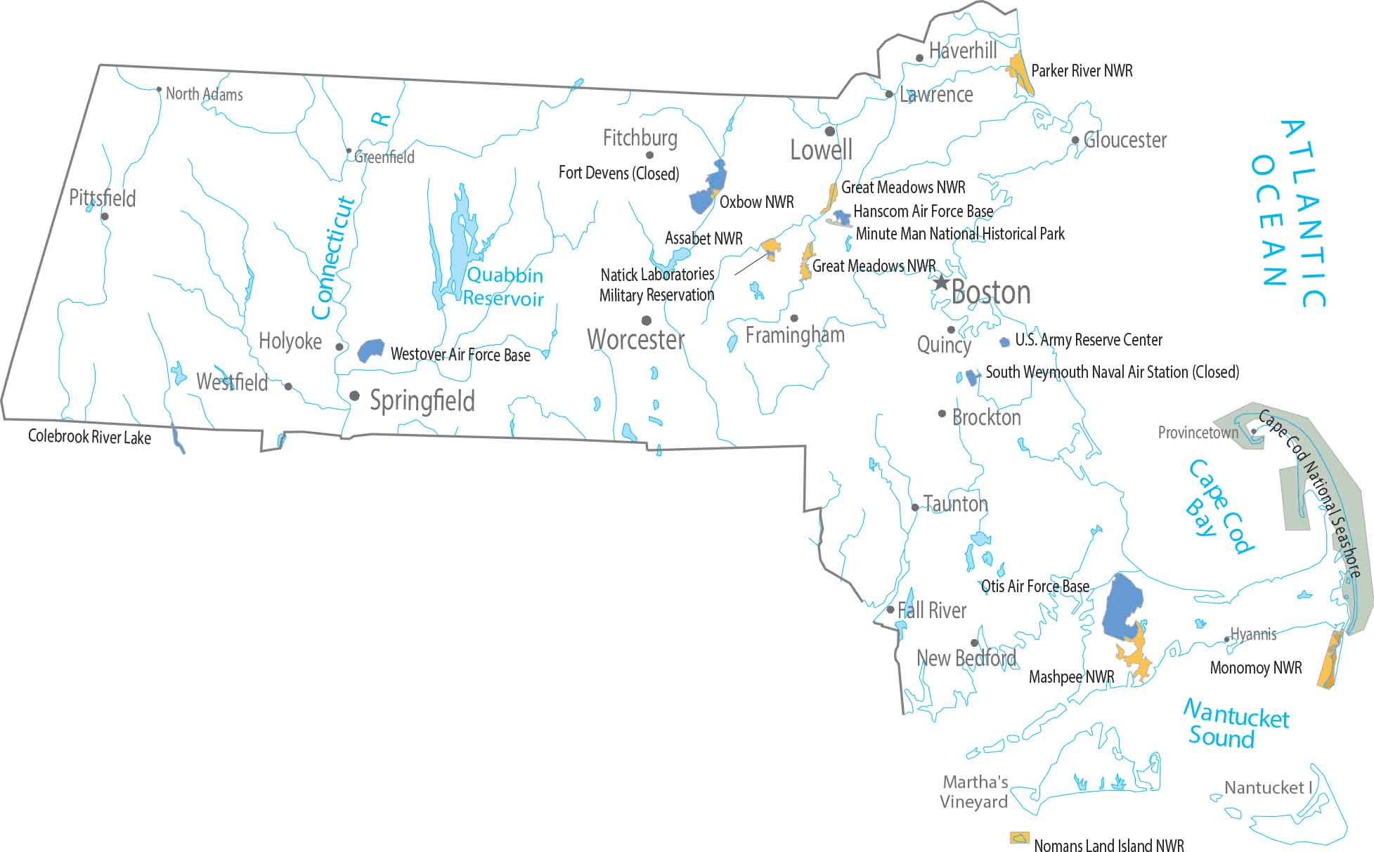
Our map shows how this tiny state crams an ocean, mountains, and a giant fishhook peninsula into one package. Federal land is mostly Cape Cod National Seashore. The rest is mostly revolution-era historic sites and national wildlife refuges.
Map Information
On the Map
Parks, Forests and Federal Lands
National Wildlife Refuges (NWR): Assabet NWR, Great Meadows NWR, Mashpee NWR Monomoy NWR, Nomans Land Island NWR, Oxbow NWR, Parker River NWR Major Islands: Martha’s Vineyard, Nantucket Island Landmarks: Cape Cod National Seashore, Colebrook River Lake, Minute Man National Historical Park Army, Naval and Military: Hanscom Air Force Base, Natick Laboratories Military Reservation, Otis Air Force Base, U.S. Army Reserve Center, Westover Air Force BaseLand Information
State Capital: Boston Major Cities: Brockton, Cambridge, Lowell, Springfield, Worcester Cities and Towns: Fall River, Fitchburg, Framingham, Gloucester, Greenfield, Haverhill, Holyoke, Hyannis, Lawrence, New Bedford, North Adams, Pittsfield, Plymouth, Provincetown, Quincy, Taunton, Westfield Lakes and Reservoirs: Atlantic Ocean, Cape Cod Bay, Nantucket Sound, Quabbin Reservoir Rivers and Streams: Connecticut RiverMassachusetts State Maps
Here’s our state maps of Massachusetts


