Map of Sunnyvale, California
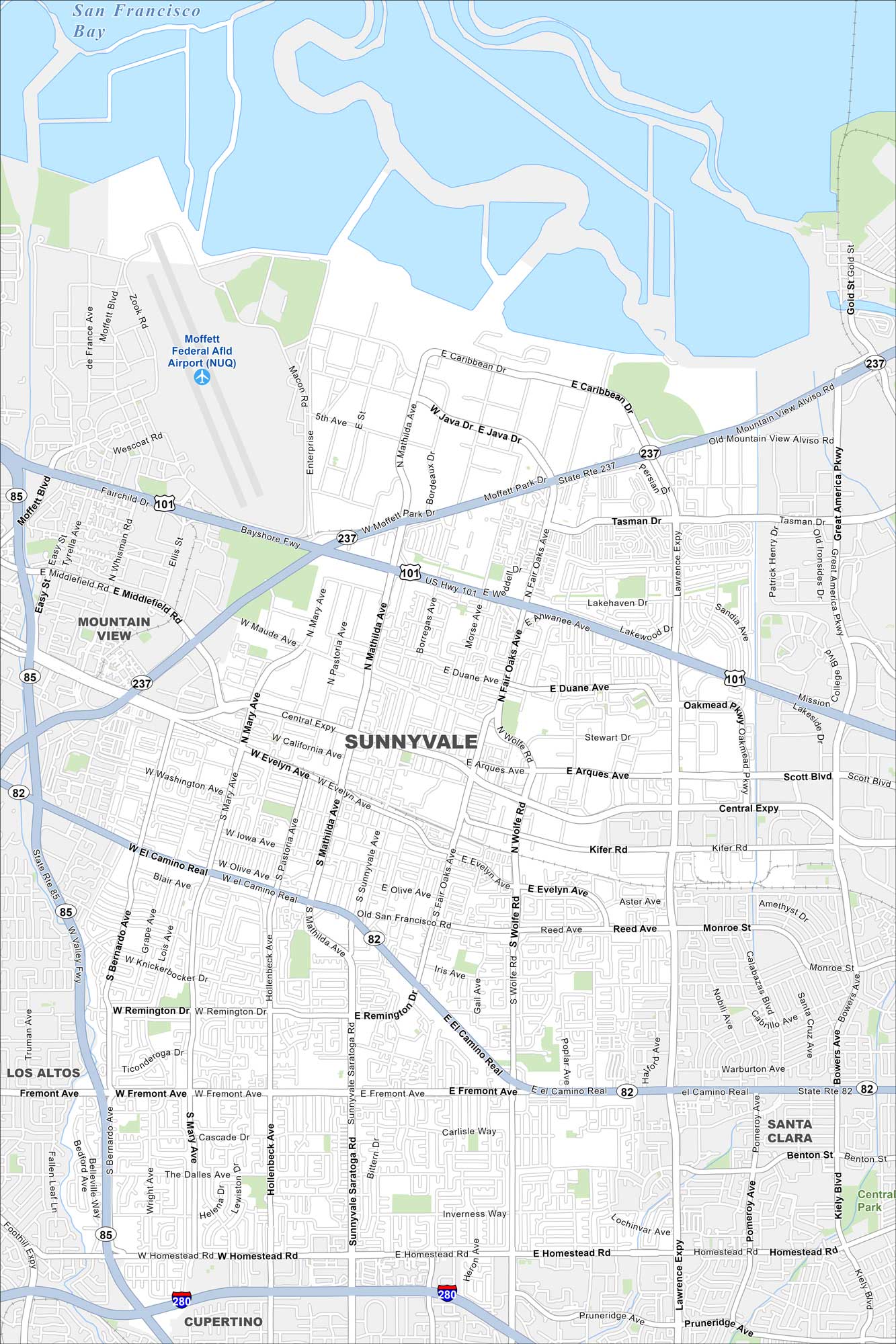
Our map of Sunnyvale shows a busy city in the middle of Silicon Valley. Neighborhood parks balance out the tech hub feel. You can find San Francisco Bay directly to the north.
California State Maps
Explore California with our state maps


Map Information
On the Map
Interstates/Highways: I-280, US Hwy 101, State Rte 237, State Rte 82, State Rte 85 Major Roads: El Camino Real, Mathilda Ave, Sunnyvale Saratoga Rd, Central Expy, Lawrence Expy, Mary Ave, Wolfe Rd, Fair Oaks Ave, Homestead Rd, Remington Dr, Fremont Ave, Evelyn Ave, Java Dr, Caribbean Dr, Tasman Dr, Arques Ave, Duane Ave, Kifer Rd Airports: Moffett Federal Afld Airport (NUQ) Lakes and Reservoirs: San Francisco Bay Parks and Preserves: Central Park Nearby Communities: Mountain View, Los Altos, Cupertino, Santa ClaraCalifornia City Maps
Here are detailed maps of California


