Map of Ukiah, California
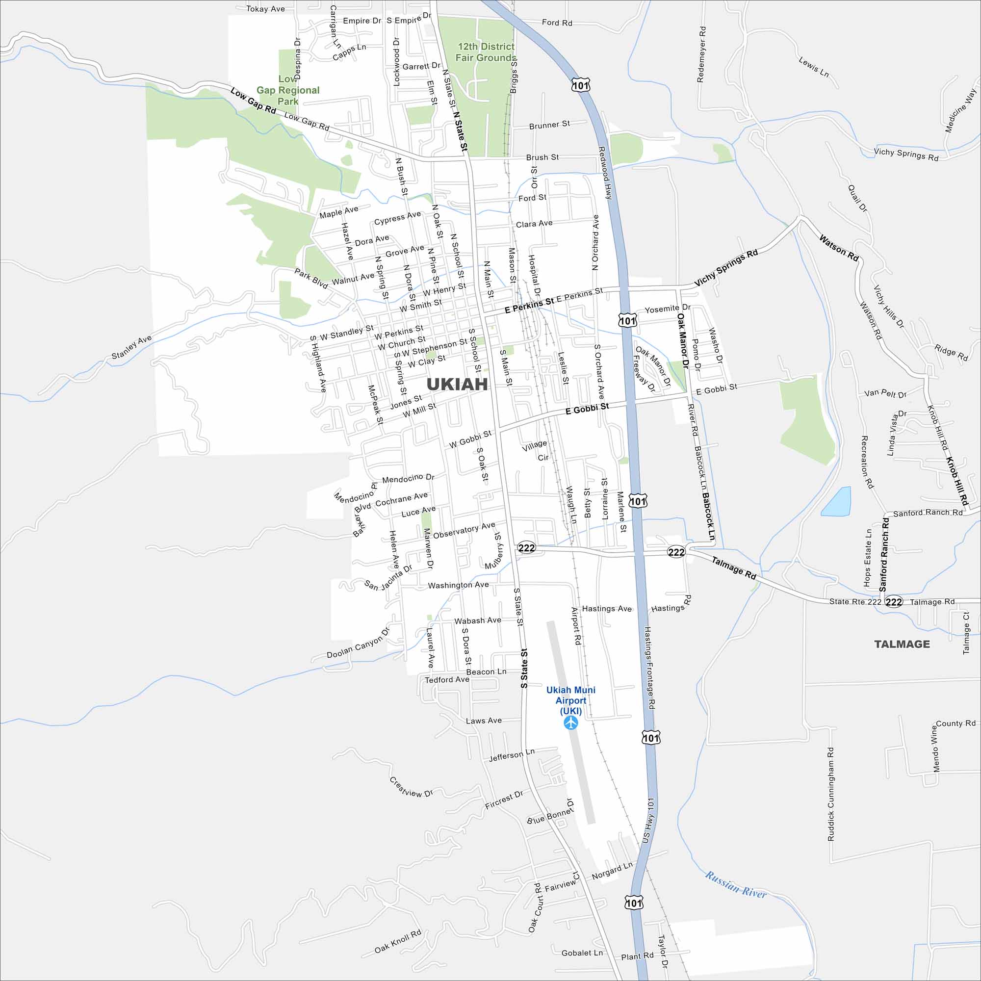
Our Ukiah map shows you around this Mendocino County hub. Surrounded by vineyards and redwood country, it blends small-town life with wine country.
California State Maps
Explore California with our state maps


Map Information
On the Map
Interstates/Highways: US Hwy 101, State Rte 222 Major Roads: State St, Perkins St, Gobbi St, Talmage Rd, Orchard Ave, Main St, Dora Ave, School St, Oak St, Low Gap Rd, Brush St, Ford St, Sanford Ranch Rd, Vichy Springs Rd, North Rd, Airport Rd, Taylor Dr, Cunningham Rd, Laws Ave, Clay St Airports: Ukiah Muni Airport (UKI) Major Rivers: Russian River Parks and Preserves: 12th District Fair Grounds, Low Gap Regional Park Nearby Communities: TalmageCalifornia City Maps
Here are detailed maps of California


