Milwaukee Historic Third Ward Map
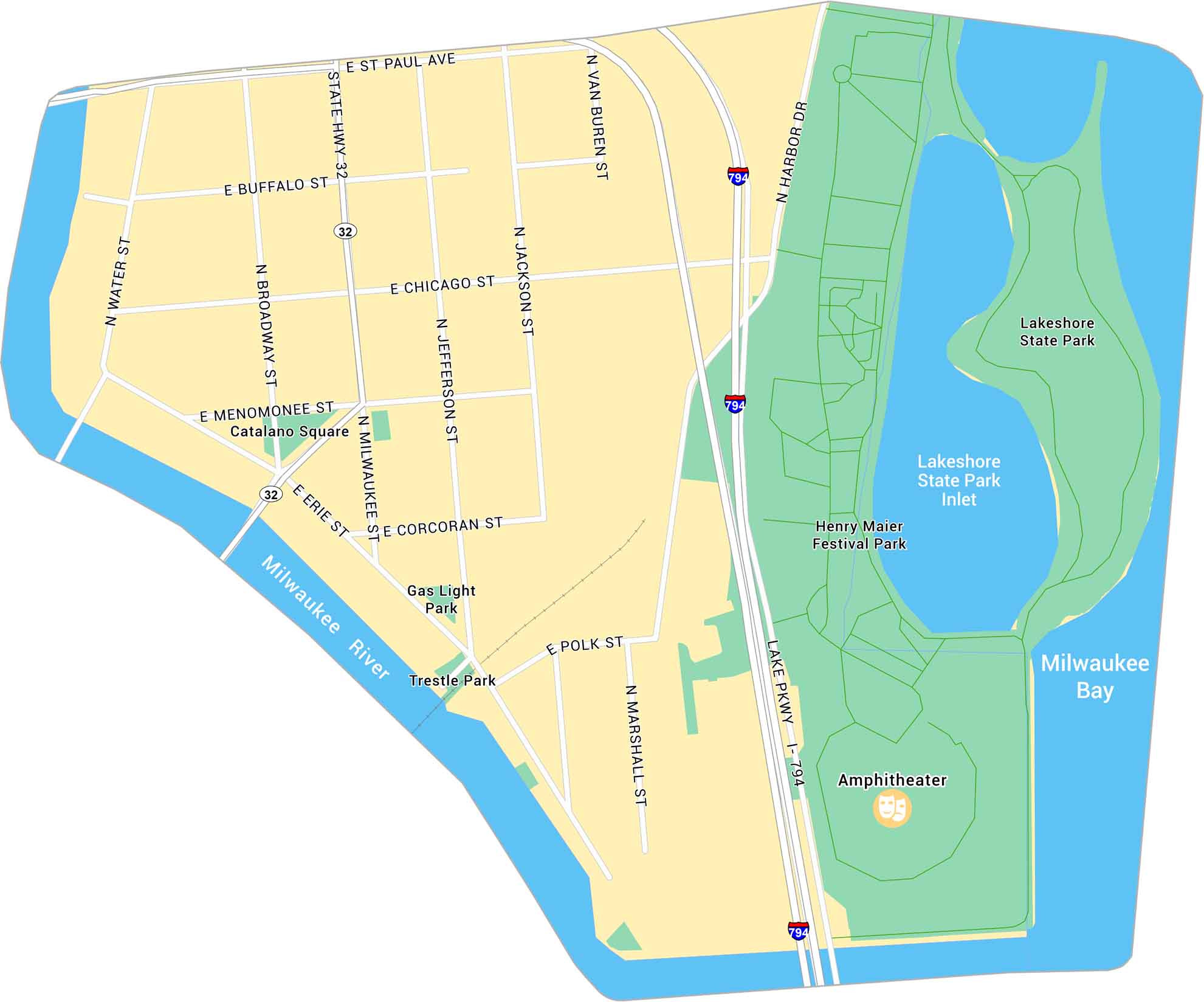
Our map of Milwaukee’s Historic Third Ward highlights its riverwalks, lakeshore park, and proximity to Lake Michigan. It’s a compact district full of art, food, and character.
Map Information
Milwaukee Neighborhood Maps
See our neighborhood maps for a closer look of the city.
On the Map
Interstates/Highways: I-794, State Hwy 32 Major Roads: Water St, Broadway, Milwaukee St, Jefferson St, Jackson St, Van Buren St, Marshall St, Harbor Dr, St Paul Ave, Buffalo St, Chicago St, Menomonee St, Erie St, Corcoran St, Polk St Bays/Rivers: Milwaukee River, Milwaukee Bay, Lakeshore State Park Inlet Parks: Lakeshore State Park, Henry Maier Festival Park, Catalano Square, Gas Light Park, Trestle Park Landmarks: AmphitheaterCity Maps of Wisconsin
See our Wisconsin maps designed for clarity.


