Map of Worcester, Massachusetts
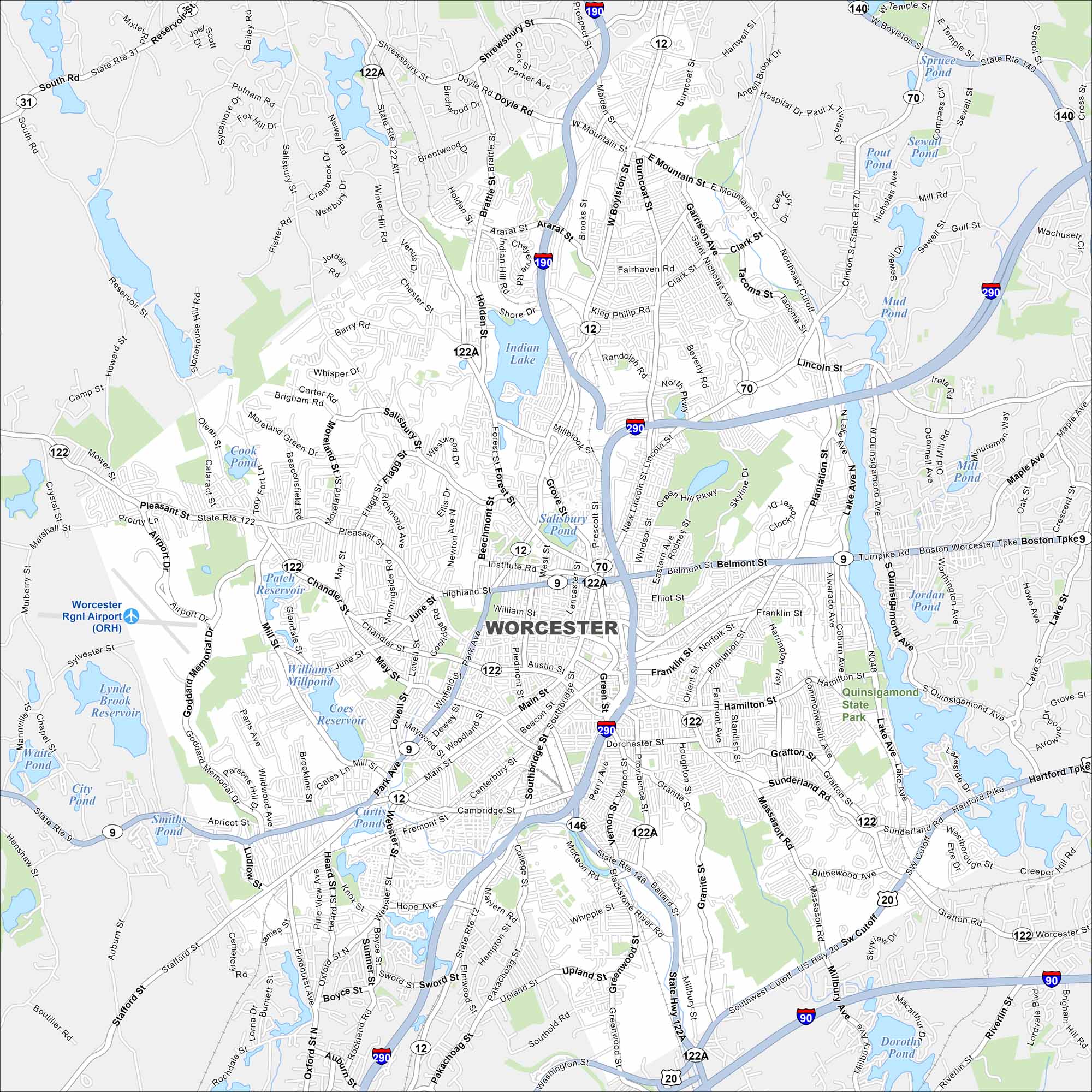
This Worcester map shows the state’s second-largest city. From its downtown core to surrounding hills, it’s a central hub of New England.
Map Information
On the Map
Interstates/Highways: I-190, I-290, I-90, US Hwy 20, State Rte 9, State Rte 12, State Rte 31, State Rte 70, State Rte 122, State Rte 122A, State Rte 140, State Rte 146 Major Roads: Main St, Salisbury St, Pleasant St, Chandler St, Highland St, Belmont St, Grafton St, Millbury St, West Boylston St, Burncoat St, Lincoln St, Plantation St, Park Ave, Southbridge St, Cambridge St, Greenwood St, Mill St, June St, Mountain St, Ararat St Airports: Worcester Rgnl Airport (ORH) Lakes and Reservoirs: Indian Lake, Salisbury Pond, Coes Reservoir, Curtis Ponds, Patch Reservoir, Cook Pond, Jordan Pond, Dorothy Pond, Mud Pond, Pout Pond, Sewall Pond, Spruce Pond, City Pond, Smiths Pond, Waite Pond, Lynde Brook Reservoir Parks and Preserves: Quinsigamond State ParkMassachusetts State Maps
Here’s our state maps of Massachusetts


City Maps of Massachusetts
Explore Boston and other urban areas in Massachusetts


