Map of Woburn, Massachusetts
Our map of Woburn shows you the historic side of New England. The city is north of Boston and combines old neighborhoods with modern industry.
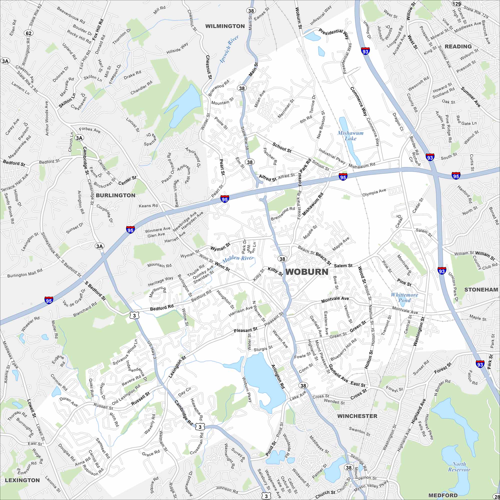
Map Information
On the Map
Interstates/Highways: I-93, I-95, State Rte 3, State Rte 3A, State Rte 38, State Rte 62, State Rte 129 Major Roads: Main St, Salem St, Montvale Ave, Washington St, Commerce Way, Pleasant St, Russell St, Cambridge Rd, Lexington St, Winn St, Bedford Rd, School St, Forest Park Rd, Industrial Pkwy, Mishawum Rd, Alfred St, Pearl St, Wood St, South St, Dragon Ct Lakes and Reservoirs: Mishawum Lake, Whittemore Pond, North Reservoir Major Rivers: Ipswich River, Malden River Nearby Communities: Wilmington, Reading, Stoneham, Winchester, Medford, Lexington, BurlingtonMassachusetts State Maps
Here’s our state maps of Massachusetts


City Maps of Massachusetts
Explore Boston and other urban areas in Massachusetts


